Forest Heights in Prince George's County, Maryland — The American Northeast (Mid-Atlantic)
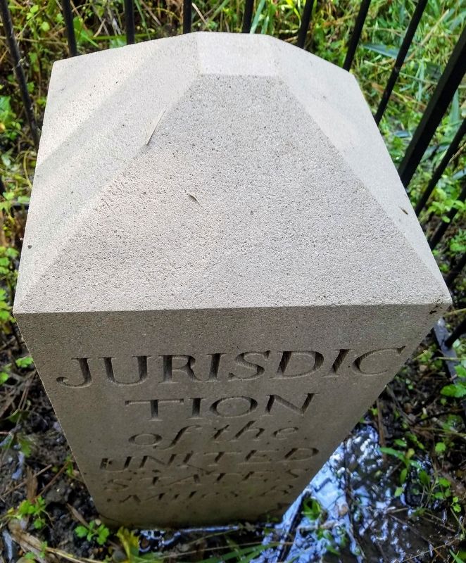
Original Federal Boundary Stone, District of Columbia, Southeast 8
Inscription.
Miles 8
1792 Replica Erected 2015
Maryland
Var 0⁰ 34’ E
Erected 2015 by Monticello Chapter, District of Columbia Daughters of the American Revolution.
Topics and series. This historical marker is listed in this topic list: Political Subdivisions. In addition, it is included in the Daughters of the American Revolution, and the Original Federal Boundary Stones series lists. A significant historical year for this entry is 1792.
Location. 38° 48.658′ N, 77° 0.849′ W. Marker is in Forest Heights, Maryland, in Prince George's County. Located on the Southeast fenceline of the Blue Plains Impound Lot. There are no crossroads, the nearest ingress point is the Oxon Hill Farm Trail appoximately 800 meters to the northeast. Touch for map. Marker is in this post office area: Oxon Hill MD 20745, United States of America. Touch for directions.
Other nearby markers. At least 8 other markers are within walking distance of this marker. Oxon Cove, the Potomac, and the Chesapeake (approx. half a mile away); The Capture of Alexandria (approx. half a mile away); The Potomac Highway (approx. 0.6 miles away); Rockets on the Hill (approx. 0.6 miles away); War Comes to Mount Welby (approx. 0.6 miles away); Root Cellar (approx. 0.7 miles away); Mount Welby (approx. 0.7 miles away); The DeButts Family Comes to Maryland (approx. 0.7 miles away).
Credits. This page was last revised on August 16, 2020. It was originally submitted on July 29, 2020, by Roberto Bernate of Arlington, Virginia. This page has been viewed 114 times since then and 19 times this year. Last updated on August 15, 2020, by Roberto Bernate of Arlington, Virginia. Photo 1. submitted on July 29, 2020, by Roberto Bernate of Arlington, Virginia. • Devry Becker Jones was the editor who published this page.
