
Cordelia and the Fire
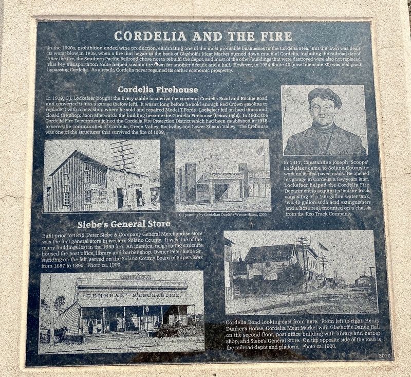
(caption upper left and middle photos:)
Cordelia Firehouse
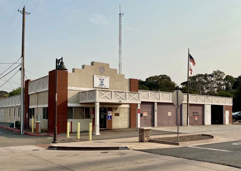
Ia 1919, C.J. Lockefeer bought the livery stable located at the corner of Cordelia Road and Ritchie Road and converted it into a garage (below left). It wasn't long before he sold enough Red Crown gasoline to replace it with a new shop where he sold and repaired Model T Fords. Lockefeer fell on hard times and closed the shop; soon afterwards the building became the Cordelia Firehouse
this page online
(caption upper right photo:)
In 1917, Constantine Joseph "Scoops" Lockefeer came to Solano County to work on its first his garage in Cordelia a few years later. Lockefeer helped the Cordelia Fire Department to acquire its first fire truck, consisting of a 100 gallon water tank, two 40 gallon soda acid extinguishers, and a hose reel, mounted on a chassis from the Reo Truck Company.
(caption lower left photo:)
Siebe's General Store
Built prior to 1875. Peter Siebe & Company General Merchandise store was the first general store in western Solano County. It was one of the many buildings lost in the 1939 fire. An identical neighboring structure housed the post office, library and barber shop. Owner Peter Siebe Sr., standing on the left, served on the Solano County Board of Supervisors from 1887 to 1895. Photo ca. 1900.
(caption lower right photo:)
Cordelia
Erected 2010.
Topics and series. This historical marker is listed in these topic lists: Disasters • Industry & Commerce. In addition, it is included in the Native Sons/Daughters of the Golden West series list. A significant historical year for this entry is 1939.
Location. 38° 12.664′ N, 122° 7.987′ W. Marker is in Cordelia, California, in Solano County. It is at the intersection of Cordelia Road and Ritchie Road, on the right when traveling west on Cordelia Road. Touch for map. Marker is at or near this postal address: 2155 Cordelia Road, Fairfield CA 94534, United States of America. Touch for directions.

Regionally, this marker is in California’s San Francisco Bay Area, in the Sacramento Valley, and specifically in the Central Valley. It is also on the American Pacific Coast. Globally, it is in North America, on
Other nearby markers. At least 8 other markers are within 3 miles of this marker, measured as the crow flies: Cordelia (a few steps from this marker); Cordelia: A Thriving Town (a few steps from this marker); Thompson's Corner Saloon - 1902 (a few steps from this marker); The Dunker House (about 700 feet away, measured in a direct line); Cordelia Begins (approx. ¼ mile away); Village of Cordelia Historic District (approx. ¼ mile away); Burial Site of Chief Solano (approx. 1.6 miles away); Rockville Station (approx. 2.4 miles away). Touch for a list and map of all markers in Cordelia.
Credits. This page was last revised on August 23, 2020. It was originally submitted on August 22, 2020, by Andrew Ruppenstein of Lamorinda, California. This page has been viewed 1,042 times since then and 58 times this year. Photos: 1, 2, 3. submitted on August 22, 2020, by Andrew Ruppenstein of Lamorinda, California.
