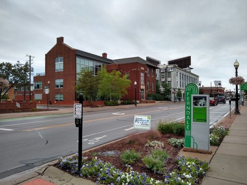
Ferndale in Oakland County, Michigan — The American Midwest (Great Lakes)
Evangelical Association / Ferndale Fun Fact #3 / Ferndale History
Inscription.
(Side 1)
Evangelical Association
Historical Site
165 E. Nine Mile
The Evangelical Association was the first church founded in Ferndale and the congregation began meeting in 1916 in a storefront on Woodward Avenue as the "North Woodward Mission" of the Evangelical Association. In 1917, the state affiliation "Church Extension Society" of the Michigan Conference of the Evangelical Association of Bay City, Michigan", purchased lots at the corner of East Nine Mile Road and Bermuda and constructed a wood frame church called "The Tabernacle".
In 1920, the present brick building was constructed and the wood frame building was moved west to what are now parking lots and was used until 1927 by the City of Ferndale Police and Fire Departments. Following several mergers on the national level, the church was renamed St. Paul's United Methodist Church.
In 2003, the congregation was dissolved and the United Methodist Church sold the building to the Jeffries Baptist Church, a Detroit congregation. They subsequently sold the church in 2008 to a private owner.
Ferndale wayfinding signage is being supported in part by a Preserve America grant administered by the National Park Service, Department of the Interior
(Side 2)
Ferndale Fun Fact #3
The first settlers in the early 1800's migrated inland from Detroit, New York and Canada for the quest of homesteads using the Saginaw Indian trail that traversed the swamps and marshlands of Ferndale, along the routes that are now Woodward Avenue and Pinecrest Road. The first permanent resident, Jabez White, a shoemaker, settled in 1821 in a log cabin he built on the site near current day Ferndale High School on Pinecrest Road.
Ferndale History
Like most of the communities surrounding Woodward Avenue north of Detroit, Ferndale began as a rural area with the earliest non-native American settler arriving in 1821. Originally part of Royal Oak Township, the community had farms and provided a resting point and services for those traveling on Woodward Avenue from Detroit to Pontiac in the first half of the 1800s. In 1890, the Campbell farm near Hilton Road was platted for summer cottages and Ferndale's population began to increase as a rural resort community outside of Detroit. Transportation to the area improved with the arrival of the Detroit Suburban Railway in 1890 and the paving of Woodward Avenue in 1912. The area was platted into subdivisions from 1910 through 1924.
With 1,600 people, Ferndale became a village in 1918. There were two churches, three schools (including the school at Woodward and Nine Mile Road) and six stores. During the next seven
years the population increased dramatically. This growth was primarily influenced by the construction of Ford Motor Company's Highland Park Plant located two miles south on Woodward. By 1924, the village's population reached 24,000 and in 1927 Ferndale became a city. The years following World War II brought additional growth to Ferndale in the number of residents and businesses, including new industries. The last 20 years of major efforts to bring new businesses and improvements to the downtown commercial area has created new vitality in the city and its residential neighborhoods.
Ferndale wayfinding signage is being supported in part by a Preserve America grant administered by the National Park Service, Department of the Interior
Erected 2011 by Ferndale Downtown Development Authority.
Topics. This historical marker is listed in these topic lists: Churches & Religion • Settlements & Settlers. A significant historical year for this entry is 1916.
Location. 42° 27.642′ N, 83° 7.974′ W. Marker is in Ferndale, Michigan, in Oakland County. Marker is at the intersection of East Nine Mile Road and Bermuda Street, on the left when traveling west on East Nine Mile Road. Touch for map. Marker is in this post office area: Ferndale MI 48220, United States of America. Touch for directions.
Other nearby markers. At least 8 other markers are within walking distance of this marker. Ferndale School (within shouting distance of this marker); 100 Year Anniversary
(within shouting distance of this marker); Ferndale Center Building (about 400 feet away, measured in a direct line); The Lux Building (about 400 feet away); The Badder Building (about 400 feet away); The Professional Building (about 400 feet away); The Inter-Urban Railcar - Detroit United Railway (about 500 feet away); Deputy Albert Anderson (about 500 feet away). Touch for a list and map of all markers in Ferndale.
Also see . . . Ferndale's Oldest Church Demolished. Article in OaklandCountyTimes.com about the demolition of the church on December 8, 2014. Includes a video of the demolition. (Submitted on August 28, 2020, by Joel Seewald of Madison Heights, Michigan.)
Credits. This page was last revised on August 28, 2020. It was originally submitted on August 28, 2020, by Joel Seewald of Madison Heights, Michigan. This page has been viewed 128 times since then and 20 times this year. Photos: 1, 2, 3. submitted on August 28, 2020, by Joel Seewald of Madison Heights, Michigan.


