Near Montalba in Anderson County, Texas — The American South (West South Central)
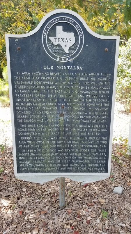
Old Montalba
In area known as Beaver Valley, settled about 1853 -- the year that pioneer P. G. Oldham built his home a half-mile northwest of this marker. This was on the Palestine-Athens Road, the route taken by mail hacks in early days. To the east was a campground where travelers often spent the night, and where later inhabitants of the area used to gather for seasonal religious campmeetings. Near the Oldham home was the Beaver Valley Primitive Baptist Church. Mr. Oldham donated land for a cemetery adjoining the church. Nearby stood a noted early school, Beaver Academy. The church was later known by name "Holly Springs."
The first local physician, Dr. T. J. Adams, built his homestead in the woods of Beaver Valley in 1859, and conducted a wide practice until he was past 80.
During the Civil War, while the young men of the area were away in the army, an iron foundry in this valley made arms and bullets for the Confederacy.
In 1880 a post office was granted under the name Montalba -- suggested by early settler Tobe Hamlett, inspired by snowclad mountain on the horizon. Mrs. Mollie Hamlett was the first postmaster. In later years Montalba settlement was moved southward, and now thrives as a market and supply point for valley.
Erected 1970 by State Historical Survey Committee . (Marker Number 8779.)
Topics. This historical marker is listed in this topic list: Settlements & Settlers. A significant historical year for this entry is 1853.
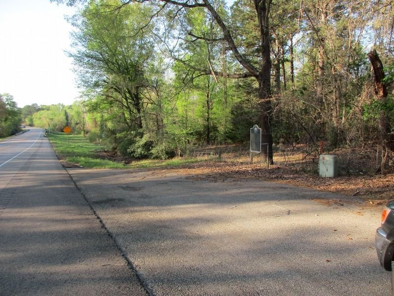
Location. 31° 55.875′ N, 95° 44.413′ W. Marker is near Montalba, Texas, in Anderson County. Marker is on Highway 19, 3˝ miles Highway 321, on the left when traveling north. Touch for map. Marker is in this post office area: Montalba TX 75853, United States of America. Touch for directions.
Other nearby markers. At least 8 other markers are within 14 miles of this marker, measured as the crow flies. Mound Prairie Cemetery (approx. 10.7 miles away); Bethel Cemetery (approx. 11 miles away); Mount Vernon United Methodist Church (approx. 11.3 miles away); Osjetea Briggs (approx. 12.8 miles away); Hodges - Darsey House (approx. 13 miles away); Seven Oaks (approx. 13.1 miles away); The I&GN Railroad in Palestine (approx. 13.1 miles away); Christopher Columbus Rogers (approx. 13.1 miles away).
Credits. This page was last revised on March 29, 2023. It was originally submitted on August 30, 2020, by James Hulse of Medina, Texas. This page has been viewed 399 times since then and 49 times this year. Photos: 1. submitted on August 30, 2020, by James Hulse of Medina, Texas. 2. submitted on March 29, 2023, by Jeff Leichsenring of Garland, Texas. 3. submitted on August 30, 2020, by James Hulse of Medina, Texas. • J. Makali Bruton was the editor who published this page.


