Elmira in Chemung County, New York — The American Northeast (Mid-Atlantic)
Harris Hill
National Landmark of Soaring
Photographed by Brian Scott, September 21, 2015
1. National Soaring Museum Monument
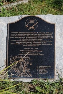
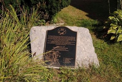
The Chemung Valley's pioneering soaring sites (*) of the early 1930's faced most of the area's prevailing winds. Take-off locations were selected daily to face the predicted winds. Gliders were launched by bungee cord into the wind so pilots could soar in the upward deflected air along the ridges or glide over the valley to seek thermal updrafts.
These take-off sites and Caton Avenue Airport were the center of activities until Harris Hill became the "Soaring Capital" in 1934.
This landmark honors the Chemung County community and the pioneering soaring pilots who flew here.
*Caton Avenue Airport
*South Mountain
*East Ridge
*Rhodes Farm (by Harris Hill)
*Close Farm
Erected 2000 by National Soaring Museum.
Topics. This historical marker is listed in these topic lists: Air & Space • Sports. A significant historical year for this entry is 1934.
Location. 42° 7.226′ N, 76° 54.017′ W. Marker is in Elmira, New York, in Chemung County. It is on Soaring Hill Drive. Located just south of The National Soaring Museum at the Harris Hill Gliderport. Touch for map. Marker is at or near this postal address: 57 Soaring Hill Drive, Elmira NY 14903, United States of America. Touch for directions.

Regionally, this marker is in Upstate New York and in the Southern Tier. It is also in the American Northeast, in the Mid-Atlantic, in Appalachia, and specifically in Northern Appalachia. Globally, it is in North America, the Western Hemisphere, the Western World, and the Anglosphere. Historically, it finds itself in what was once New Netherland and also one of the original Thirteen Colonies.
Other nearby markers. At least 8 other markers are within 4 miles of this marker, measured as the crow flies: World War II Glider Training at Harris Hill (a few steps from this marker); Rhodes Farm (approx.
this page online
Regarding Harris Hill. The Harris Hill Gliderport is known as the Soaring Capitol of America.
Photographed by Brian Scott, September 21, 2015
2. National Soaring Museum Monument
Photographed by Brian Scott, September 21, 2015
3. National Soaring Museum Monument
Credits. This page was last revised on September 21, 2020. It was originally submitted on November 8, 2015. This page has been viewed 707 times since then and 37 times this year. Last updated on September 18, 2020, by Craig Baker of Sylmar, California. Photos: 1, 2, 3. submitted on November 8, 2015, by Brian Scott of Anderson, South Carolina. • J. Makali Bruton was the editor who published this page.
