Iron Station in Lincoln County, North Carolina — The American South (South Atlantic)
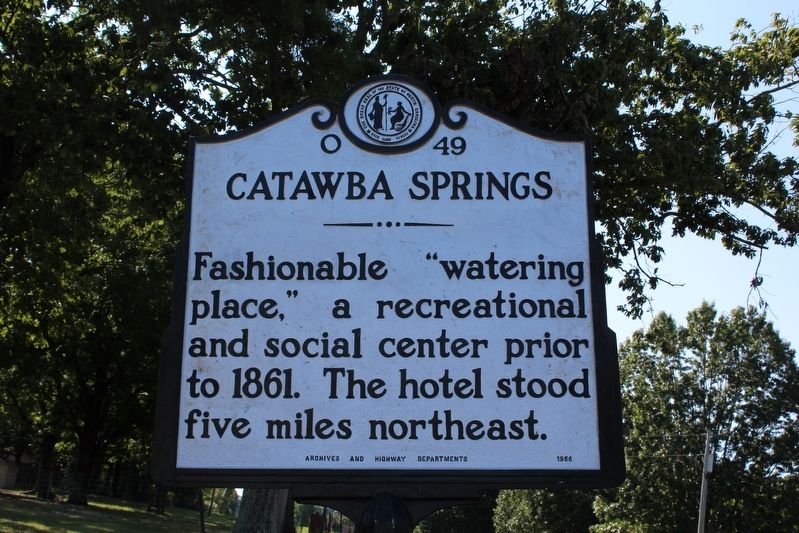
Catawba Springs
Erected 1956 by North Carolina Archives and History Departments. (Marker Number O-49.)
Topics and series. This historical marker is listed in these topic lists: Entertainment • Industry & Commerce. In addition, it is included in the North Carolina Division of Archives and History series list. A significant historical year for this entry is 1861.
Location. 35° 27.998′ N, 81° 5.146′ W. Marker is in Iron Station, North Carolina, in Lincoln County. Marker is at the intersection of State Highway 73 and Beth Haven Church Road (County Highway 1360), on the right when traveling west on State Highway 73. Touch for map. Marker is at or near this postal address: 4501 NC-73, Iron Station NC 28080, United States of America. Touch for directions.
Other nearby markers. At least 8 other markers are within 6 miles of this marker, measured as the crow flies. Machpelah Cemetery (approx. 0.2 miles away); William A. Graham (approx. 1˝ miles away); Ingleside (approx. 2.8 miles away); Peter Forney (approx. 3.2 miles away); Cottage Home (approx. 3.6 miles away); Stonewall Jackson (approx. 3.6 miles away); Iron Works (approx. 4.3 miles away); Andrew Carpenter House (approx. 5.7 miles away). Touch for a list and map of all markers in Iron Station.
Also see . . . A History of Catawba Springs, North Carolina. (Submitted on September 20, 2020, by Tom Bosse of Jefferson City, Tennessee.)
Credits. This page was last revised on September 21, 2020. It was originally submitted on September 20, 2020, by Tom Bosse of Jefferson City, Tennessee. This page has been viewed 414 times since then and 63 times this year. Photos: 1, 2. submitted on September 20, 2020, by Tom Bosse of Jefferson City, Tennessee. • Bernard Fisher was the editor who published this page.

