Near Richmond in Fort Bend County, Texas — The American South (West South Central)
John Foster
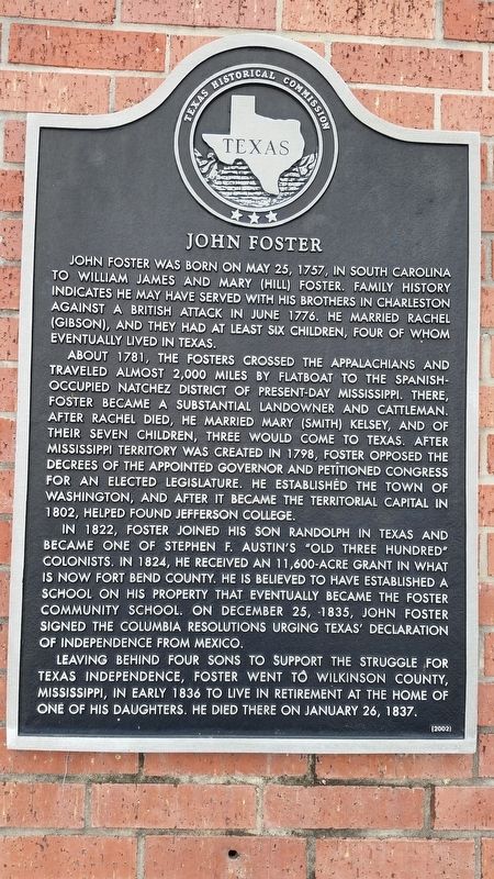
John Foster was born on May 25, 1757, in South Carolina to William James and Mary (Hill) Foster. Family history indicates he may have served with his brothers in Charleston against a British attack in June 1776. He married Rachel (Gibson), and they had at least six children, four of whom eventually lived in Texas.
About 1781, the Fosters crossed the Appalachians and traveled almost 2,000 miles by flatboat to the Spanish-occupied Natchez District of present-day Mississippi. There, Foster became a substantial landowner and cattleman. After Rachel died, he married Mary (Smith) Kelsey, and of their seven children, three would come to Texas. After Mississippi Territory was created in 1798, Foster opposed the decrees of the appointed governor and petitioned Congress for an elected legislature. He established the town of Washington, and after it became the territorial capital in 1802, helped found Jefferson College.
In 1822, Foster joined his son Randolph in Texas and became one of Stephen F. Austin's "Old Three Hundred" colonists. In 1824, he received an 11,600-acre grant in what is now Fort Bend County. He is believed to have established a school on his property that eventually became the Foster Community School. On December 25, 1835, John Foster signed the Columbia Resolutions urging Texas' declaration of independence from Mexico.
Leaving behind four sons to support the struggle for Texas Independence, Foster went to Wilkinson County, Mississippi, in early 1836 to live in retirement at the home of one of his daughters. He died there on January 26, 1837.
Erected 2002 by Texas Historical Commission. (Marker Number 12960.)
Topics. This historical marker is listed in these topic lists: Settlements & Settlers • War, Texas Independence • War, US Revolutionary. A significant historical date for this entry is January 26, 1837.
Location. 29° 37.634′ N, 95° 48.669′ W. Marker is near Richmond, Texas, in Fort Bend County. Marker is on Farm to Market Road 723, 0.1 miles south of Farm to Market Road 359, on the left when traveling south. Touch for map. Marker is at or near this postal address: 4400 FM 723, Richmond TX 77406, United States of America. Touch for directions.
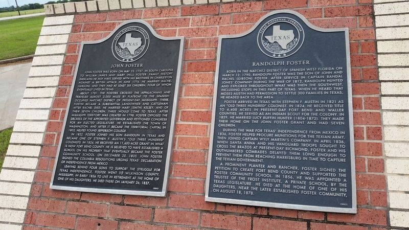
Other nearby markers. At least 8 other markers are within 4 miles of this marker, measured as the crow flies. Randolph Foster (a few steps from this marker); Foster Community (approx. 1.4 miles away); Site of Thompson's Ferry (approx. 2.4 miles away); John Foster Land Grant (approx. 2.7 miles away); John McNabb (approx. 4 miles away); Thomas Jefferson Smith (approx. 4 miles away); Morton Cemetery (approx. 4.1 miles away); Morton Cemetery Veterans Flag Pole (approx. 4.1 miles away). Touch for a list and map of all markers in Richmond.
Also see . . . John Foster. TSHA Texas State Historical Association (Submitted on September 24, 2020, by James Hulse of Medina, Texas.)
Credits. This page was last revised on September 25, 2020. It was originally submitted on September 24, 2020, by James Hulse of Medina, Texas. This page has been viewed 311 times since then and 33 times this year. Photos: 1, 2, 3. submitted on September 24, 2020, by James Hulse of Medina, Texas. • J. Makali Bruton was the editor who published this page.


