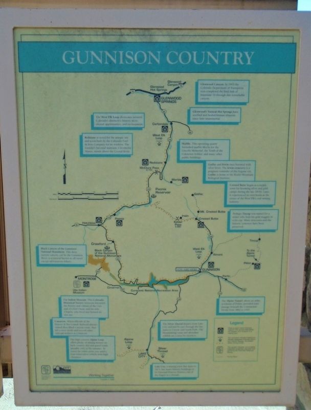
Gunnison Country
[Clockwise from top right]
Glenwood Canyon. In 1993 the Colorado Department of Transportation completed the final link of Interstate 70 through this remarkable canyon.
Glenwood's Natural Hot Springs have soothed and healed human ailments since time immemorial.
Marble. This operating quarry furnished marble blocks for the Lincoln Memorial, the Tomb of the Unknown Soldier, and many other public buildings.
Gothic and Canyon once boomed with silver fever. The Irwin cemetery is a poignant reminder of this bygone era. Gothic is home to the Rocky Mountain Biological Institute.
Crested Butte began as a supply town for booming silver and gold camps during the late 1870s. Later, it experienced its own boom as the center of the West Elk's coal mining industry.
Perhaps Tincup was named for a miner who kept his gold nuggets in a tin cup. Many structures and the historic cemetery have been preserved.
The Alpine Tunnel, about six miles northeast of Pitkin, provided train passage beneath the Continental Divide from 1882 to 1910.
The Silver Thread departs from Lake City and travels east through the San Juans to Creede and South Fork. The breathtaking vistas and abundant wildlife are a treat for travelers.
Lake City, a mining town
that dates to 1874, has many historic buildings in its National Historic District, one of the largest in Colorado.The high country Alpine Loop offers plenty of mining history on back country dirt and gravel roads, passable only in the summer. To travel the entire route you need a four-wheel drive vehicle with high clearance.
Cimarron. When officials of the Denver & Rio Grande Railroad discontinued their Black Canyon route, they left a steel trestle and several other railroad artifacts at Cimarron.
Ute Indian Museum. This Colorado Historical Society museum interprets the history and culture of the Utes and of Chief Ouray and his wife, Chipeta, who lived and farmed on this site.
Black Canyon of the Gunnison National Monument. This deep, narrow canyon, cut by the Gunnison River, is a natural barrier to all travel except adventurous hikers.
Redstone is noted for the unique inn and town built by the Colorado Fuel & Iron Company for its workers. The founder's baronial mansion, Cleveholm Manor, stands above the Crystal River.
The West Elk Loop showcases western Colorado's distinctive history, recreational opportunities, and environment.
Erected 1996 by Colorado Historical Society and Colorado Dept of Transportation.
Topics. This historical marker is listed in these topic
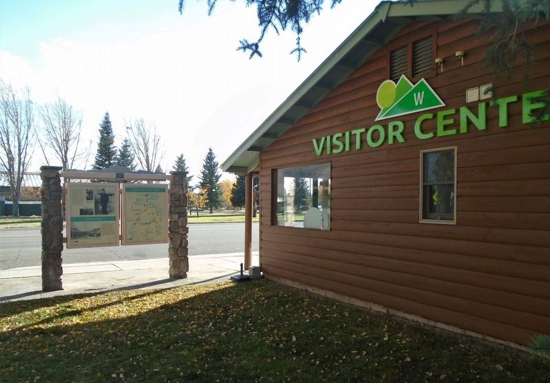
Location. 38° 32.675′ N, 106° 55.271′ W. Marker is in Gunnison, Colorado, in Gunnison County. Marker is adjacent to the Gunnison County Visitor Center, but not visible from the road. Touch for map. Marker is at or near this postal address: 500 East Tomichi Avenue, Gunnison CO 81230, United States of America. Touch for directions.
Other nearby markers. At least 8 other markers are within walking distance of this marker. Ho For The Gunnison! (here, next to this marker); Two Great Trains (here, next to this marker); King Coal (here, next to this marker); The World's Largest Collegiate Emblem! (a few steps from this marker); Bruce-Frew American Legion Post No. 54 Hut and History (about 300 feet away, measured in a direct line); Middle East [Desert Storm] War Memorial (about 500 feet away); Vietnam War Memorial (about 500 feet away); POW/MIA Memorial (about 500 feet away). Touch for a list and map of all markers in Gunnison.
Also see . . .
1. Gunnison County in Colorado Encyclopedia. (Submitted on October 27, 2020, by William Fischer, Jr. of Scranton, Pennsylvania.)
2. Tales of the Gunnison Country (KBUT Community Radio) . (Submitted on October 27, 2020, by William Fischer, Jr. of Scranton, Pennsylvania.)
Credits. This page was last revised on October 27, 2020. It was originally submitted on October 27, 2020, by William Fischer, Jr. of Scranton, Pennsylvania. This page has been viewed 149 times since then and 13 times this year. Photos: 1, 2. submitted on October 27, 2020, by William Fischer, Jr. of Scranton, Pennsylvania.

