
Death Valley National Park in Inyo County, California — The American West (Pacific Coastal)
Eagle Borax Works
Photographed by Craig Baker, October 28, 2020
1. Eagle Borax Works Marker
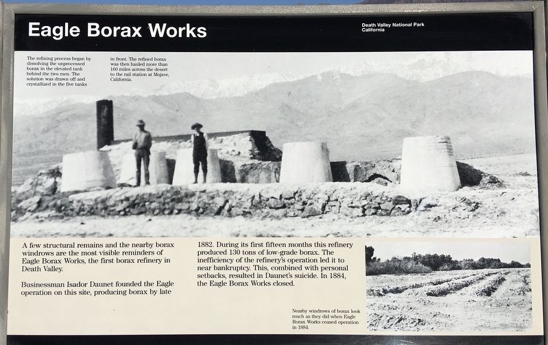
A few structural remains and the nearby borax windrows are the most visible reminders of Eagle Borax Works, the first borax refinery in Death Valley.
Businessman Isador Daunet founded the Eagle operation on this site, producing borax by late 1882. During its first fifteen months this refinery produced 130 tons of low-grade borax. The inefficiency of the refinery's operation led it to near bankruptcy. This, combined with personal setbacks, resulted in Daunet's suicide. In 1884, the Eagle Borax Works closed.
The refining process began by dissolving the unprocessed borax in the elevated tank behind the two men. The solution was drawn off and crystallized in the five tanks in front. The refined borax was then hauled more than 160 miles across the desert to the rail station at Mojave, California.
Erected by National Park Service.
Topics. This historical marker is listed in these topic lists: Industry & Commerce • Natural Resources. A significant historical year for this entry is 1882.
Location. 36° 12.035′ N, 116° 52.038′ W. Marker is in Death Valley National Park, California, in Inyo County.
this page online

Regionally, this marker is in California’s Sierra Nevada. It is also in the American Mountain West. Globally, it is in North America, on the Ring of Fire, in the Pacific Rim, in the Western Hemisphere, in the Western World, and in the Anglosphere. Historically, it finds itself in what was once New Spain and also Mexico’s Alta California.
Other nearby markers. At least 8 other markers are within 15 miles of this marker, measured as the crow flies: Shorty Harris Grave (approx. half a mile away); Bennett’s Long Camp (approx. 2.6 miles away); Badwater Pool (approx. 5.9 miles away); Devils Golf Course (approx. 6.3 miles away); West Side Road (approx. 11½ miles away); Desolation Canyon (approx. 13.6 miles away); Ryan Historic District (approx. 13.8 miles away); Aguereberry Point (approx. 14.8 miles away). Touch for a list and map of all markers in Death Valley National Park.
Another marker
Photographed by Craig Baker, October 28, 2020
2. Eagle Borax Works and Marker
More about this marker. West Side Road is a dirt road and might be closed after a rain storm. Avoid traveling in remote areas during severe weather.
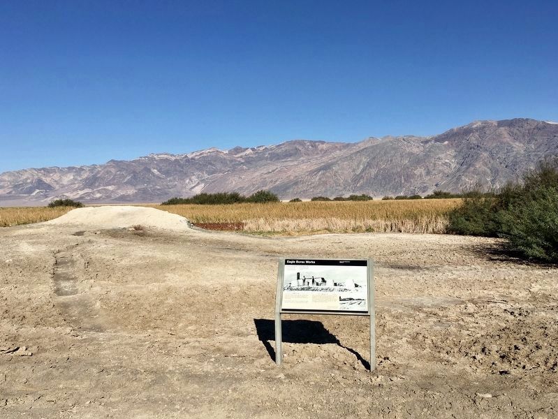
Regarding Eagle Borax Works. The remains of the borax works have been covered with soil to protect them. Eagle Borax Works is on the National Register of Historic Places.
The Twenty Mule Teams were made famous by the effective corporate branding of Pacific Coast Borax (and continued by U.S. Borax), including popular radio and TV programs that ran for decades. The campaign is credited to Stephen T. Mather (1867-1930), the marketing manager, who later made a fortune with his own borax mining company. In 1917, Mather became the first director of the National Park Service.
Photographed by Craig Baker, October 28, 2020
3. Eagle Borax Spring wetlands
Photographed by Craig Baker
4. Original Marker - circa 1970
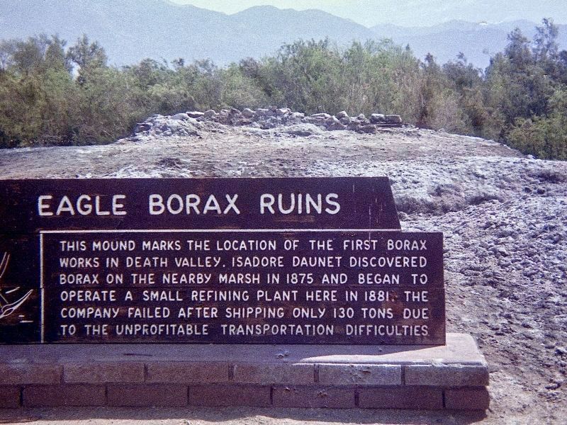
“This mound marks the location of the first borax works in Death Valley. Isador Daunet discovered borax on the nearby marsh in 1875 and began to operate a small refining plant here in 1881. The company failed after shipping only 130 tons due to the unprofitable transportation difficulties.”
Credits. This page was last revised on February 17, 2026. It was originally submitted on November 5, 2020, by Craig Baker of Sylmar, California. This page has been viewed 788 times since then and 60 times this year. Photos: 1, 2, 3. submitted on November 5, 2020, by Craig Baker of Sylmar, California. 4. submitted on May 14, 2023, by Craig Baker of Sylmar, California. • J. Makali Bruton was the editor who published this page.
