Grapeland in Houston County, Texas — The American South (West South Central)
First Baptist Church of Grapeland
Photographed by James Hulse, November 8, 2020
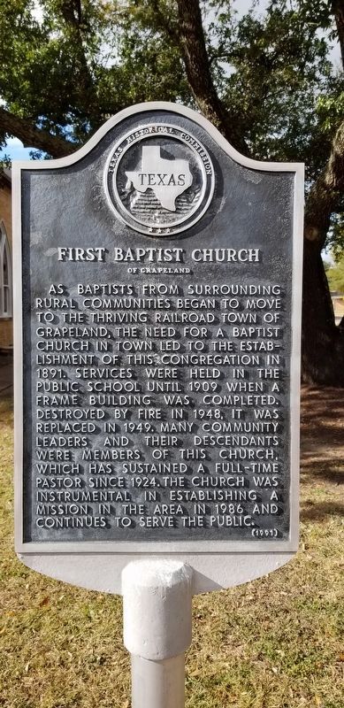
1. First Baptist Church of Grapeland Marker
As baptists from surrounding rural communities began to move to the thriving railroad town of Grapeland, the need for a Baptist Church in town led to the establishment of this congregation in 1891. Services were held in the public school until 1909 when a frame building was completed. Destroyed by fire in 1948, it was replaced in 1949. Many community leaders and their descendants were members of this church, which has sustained a full-time pastor since 1924. The Church was instrumental in establishing a mission in the area in 1986 and continues to serve the public.
Erected 1991 by Texas Historical Commission. (Marker Number 11215.)
Topics. This historical marker is listed in this topic list: Religion & Religious Structures. A significant historical year for this entry is 1891.
Location. 31° 29.412′ N, 95° 28.904′ W. Marker is in Grapeland, Texas, in Houston County. It is at the intersection of West Chestnut Street (Farm to Market Road 227) and North Olive Street, on the right when traveling south on West Chestnut Street. Touch for map. Marker is at or near this postal address: 408 West Chestnut Street, Grapeland TX 75844, United States of America. Touch for directions.

Regionally, this marker is in the American South, specifically in the Deep South, and in the Piney Woods. Globally, it is in North America, a Gulf of Mexico state, the Western Hemisphere, the Western World, and the Anglosphere. Historically, it finds itself in what was once New Spain, the Republic of Texas, one of the Confederate States of America, and the Antebellum South.
Other nearby markers. At least 8 other markers are within 5 miles of this marker, measured as the crow flies: City of Grapeland (approx. 0.2 miles away); First Christian Church (approx. ¼ mile away); Joseph Randolph Yarbrough (approx. 0.4 miles away); Franklin Columbus Woodard
this page online

Photographed by James Hulse, November 8, 2020
2. First Baptist Church of Grapeland and Marker
Photographed by James Hulse, November 8, 2020
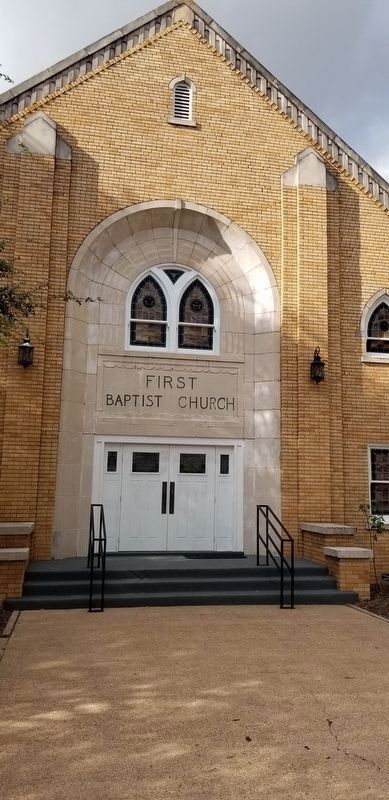
3. Front entrance to the First Baptist Church of Grapeland
Credits. This page was last revised on May 8, 2024. It was originally submitted on November 29, 2020, by James Hulse of Medina, Texas. This page has been viewed 339 times since then and 24 times this year. Photos: 1, 2, 3. submitted on November 29, 2020, by James Hulse of Medina, Texas. • J. Makali Bruton was the editor who published this page.
