Near Cartwright in McKenzie County, North Dakota — The American Midwest (Upper Plains)
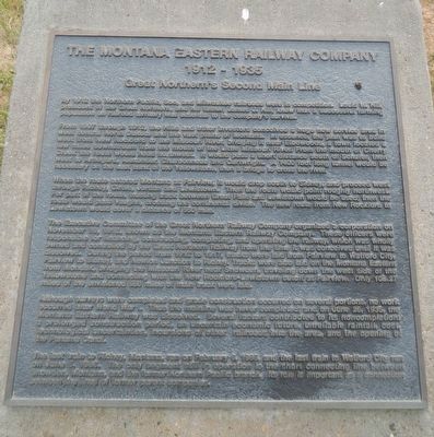
The Montana Eastern Railway Company
1912 - 1935
— Great Northern's Second Main —
From 1907 through 1912, the Hills and other investors conceived a huge new service area in west central North Dakota and the vast plains of Montana. In essence, the plan was to build west from New Rockford to the Missouri River, bridging it near Elbowoods, a town located a few miles downstream from the mouth of the Little Missouri River. From the mouth of Cherry Creek the route would head northwest. It would pass a short distance south of Schafer, then west to Amegard, Alexander, Charbonneau and Cartwright. A 1400 foot long tunnel would be necessary on the east bank of the Yellowstone, then a bridge across the river.
When the route entered Montana at Fairview, it would drop south to Sidney, and proceed west through Richey, Circle, Jordan and Lewistown. Then the route would point roughly northwest. For part of the route, existing track between Great Falls and Lewistown would be used; then the route would pas Vaughn, crossing the continental divide. The new route from New Rockford to Lewistown would cover a distance of 550 mile.
The Executive Committee of the Great Northern Railway Company organized a corporation on November19, 1912, known as the Montana Eastern Railway Company. These officers were responsible for financing, constructing, completing, and operating the railway, which was wholly owned and controlled by the Great Northern Railway from the time it was conceived until it was dissolved. During the period from 1912 to 1917, tracks were laid from Fairview to Watford City, Fairview to Sidney, and Newton Junction to Richey. Tracks were also laid on on the Montana Eastern from Mondak, bridging the Missouri River near Snowden, traveling down the west side of the Yellowstone and connecting with the New Rockford-Lewistown cutoff at Fairview. Only 108.27 miles of the envisioned 550 miles of main track were laid.
Although surveys were completed and grade construction occurred on several portions, no work occurred after World War I. Thus the mainline was never completed; and on June 26, 1935, the Montana Eastern Railway was dissolved. Several factors contributed to its non completion: a prolonged construction period, an uncertain economic future, unreliable rainfall, cost, technological uncertainties, incursions of other railroads into the area, and the opening of the Panama Canal.
The last train to Richey, Montana, ran on February 6, 1985, and the last train to Watford City on June 5, 1966.
The only segment still in operation is the short connecting line between Snowdon, Montana, and the former Northern Pacific branch. Its role is important as a connection between the lines of former parent companies.
Topics. This historical marker is listed in this topic list: Railroads & Streetcars.
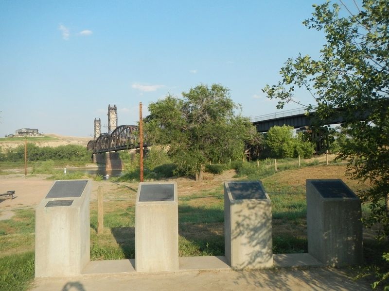
Location. 47° 51.518′ N, 103° 58.158′ W. Marker is near Cartwright, North Dakota, in McKenzie County. Marker can be reached from Black Top Road near State Highway 200. The marker is in Sundheim Park near the lift bridge. Touch for map. Marker is in this post office area: Cartwright ND 58838, United States of America. Touch for directions.
Other nearby markers. At least 8 other markers are within 9 miles of this marker, measured as the crow flies. Hjalmer Nelson Memorial Bridge (here, next to this marker); Fairview Lift Bridge (here, next to this marker); The Cartwright Tunnel (here, next to this marker); Mining Lignite Coal (approx. 3˝ miles away in Montana); Plants of the Plains (approx. 8.6 miles away); Water Ways and Mean (approx. 8.6 miles away); Mosquitoes (approx. 8.8 miles away); Missouri-Yellowstone Confluence (approx. 8.8 miles away). Touch for a list and map of all markers in Cartwright.
Credits. This page was last revised on December 9, 2020. It was originally submitted on December 9, 2020, by Barry Swackhamer of Brentwood, California. This page has been viewed 305 times since then and 48 times this year. Photos: 1, 2. submitted on December 9, 2020, by Barry Swackhamer of Brentwood, California.

