
Willington in Capitol Region, Connecticut — The American Northeast (New England)
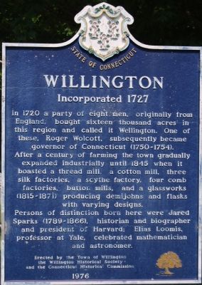
Willington
Incorporated 1727
Photographed by Dawn Bowen, July 10, 2007
1. Willington Marker
After a century of farming the town gradually expanded industrially until 1845 when it boasted a thread mill, a cotton mill, three silk factories, a scythe factory, four comb factories, button mils, and a glassworks (1815–1871) producing demijohns and flasks with varying designs.
Persons of distinction born here were Jared Sparks (1789–1866), historian and biographer and president of Harvard; Elias Loomis, professor at Yale, celebrated mathematician and astronomer.
Erected 1976 by Town of Willington, the Willington Historical Society, and the Connecticut Historical Commission.
Topics. This historical marker is listed in these topic lists: Government & Politics • Industry & Commerce • Settlements & Settlers. A significant historical year for this entry is 1720.
Location. 41° 52.531′ N, 72° 15.85′ W. Marker is in Willington in Capitol Region, Connecticut. It is at the intersection
this page online

Regionally, this marker is in the American Northeast and in New England. Globally, it is in North America, the Western Hemisphere, the Western World, and the Anglosphere. Historically, it finds itself in what was once Tolland County and also one of the original Thirteen Colonies.
Other nearby markers. At least 8 other markers are within 5 miles of this marker, measured as the crow flies: Town of Willington, Connecticut (within shouting distance of this marker); The Federated Church of Willington (within shouting distance of this marker); Baptist Church of Willington (within shouting distance of this marker); This Edifice (about 300 feet away, measured in a direct line); a different marker also named Willington (approx. 2.2 miles away); a different marker also named Willington (approx. 2.4 miles away); Historic Horsebarn Hill (approx. 4.4 miles away); A Familiar Vista (approx. 4.4 miles away). Touch for a list and map
Photographed by Dawn Bowen, July 10, 2007
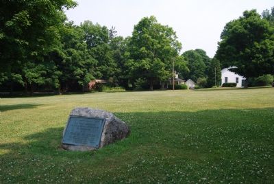
2. The Green at Willington
“1727————1927. This tablet commemorates the two hundredth anniversary of the incorporation of the Town of Willmington. Here amid these picturesque hills our forefathers and foremothers toiled for the sake of a goodly heritage. We should do no less.”
Credits. This page was last revised on May 19, 2026. It was originally submitted on July 11, 2007, by Dawn Bowen of Fredericksburg, Virginia. This page has been viewed 2,281 times since then and 44 times this year. Photos: 1, 2. submitted on July 11, 2007, by Dawn Bowen of Fredericksburg, Virginia. • J. J. Prats was the editor who published this page.
Editor’s want-list for this marker. Wide shot showing this marker and its surroundings • Can you help?
