Near Stanton in Mercer County, North Dakota — The American Midwest (Upper Plains)
Fort Clark (circa 1830-1860)
Fort Clark State Historic Site

Photographed By Barry Swackhamer, August 28, 2020
1. Fort Clark (circa 1830-1860) Marker
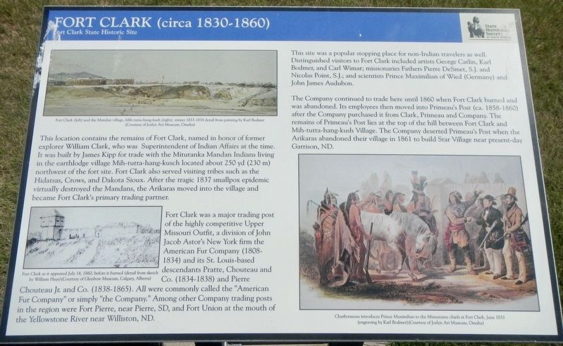
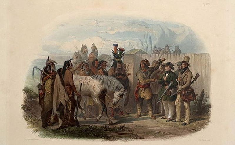
Captions: (upper left) Fort Clark (left) and the Mandan village, Mih-tutta-hang-kush (right), winter 1833 detail from panting by Karl Bodmer.; (lower left) Fort Clark as it appeared July 14, 1860, before it burned (detail from sketch by William Hays).; Charbonneau introduces Prince Maximilian to the Minnataree chiefs at Fort Clark, June 1833.
Fort Clark was a major trading post of the highly competitive Upper Missouri Outfit, a division of John Jacob Astor's New York firm the American Fur Company (1808-1834) and its St. Louis-based descendants Pratte, Chouteau and Co. (1834-1838) and Pierre Chouteau Jr. and Co. (1838-1865). All were commonly called the "American Fur Company" or simply "the Company." Among other Company trading posts in the region were Fort Pierre, near Pierre, SD, and Fort Union at the mouth of the Yellowstone River near Williston, ND.
This site was a popular stopping place for non-Indian travelers as well. Distinguished visitors to Fort Clark included artists George Catlin, Karl Bodmer, and Carl Wimar, missionaries Fathers Pierre DeSmet, S.J. and Nicolas Point, S.J.; and scientists Prince Maximilian of Weid ( Germany) and John James Audubon.
The Company continued to trade here until 1860 when Fort Clark burned and was abandoned. Its employees then moved into Primeau's Post (ca. 1858-1860) after the Company purchased it from Clark, Primeau and Company. The remains of Primeau's Post lies at the top of the hill between Fort Clark and Mih-tutta-hang-kush Village. The Company deserted Primeau's Post when the Arikaras abandoned their village in 1861 to build Star Village near present-day Garrison, ND.
Erected by State Historical Society of North Dakota.
Topics. This historical marker is listed in this topic list: Forts and Castles.
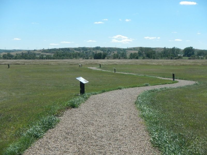
Location. 47° 15.083′ N, 101° 16.356′ W. Marker is near Stanton, North Dakota, in Mercer County. Marker can be reached from 37th Avenue Southwest near 12th Street Southwest (State Highway 200), on the right when traveling north. The marker is located at the Fort Clark State Historic Site. Touch for map. Marker is in this post office area: Stanton ND 58571, United States of America. Touch for directions.
Other nearby markers. At least 8 other markers are within walking distance of this marker. The People (here, next to this marker); Missouri Valley Environs (within shouting distance of this marker); Pierre Garreau's Lodge (within shouting distance of this marker); Winter Villages and Lodges
(within shouting distance of this marker); Stone Shelter (within shouting distance of this marker); Geophysics and Archaeology (about 300 feet away, measured in a direct line); The Blockhouses (about 300 feet away); Two Bourgeois or Head Traders of the Fort (about 300 feet away). Touch for a list and map of all markers in Stanton.
Also see . . . Fort Clark State Historic Site - History -- State Historical Society of North Dakota. (Note: 2 pages) In 1830-1831, James Kipp, an employee of American Fur Company, built Fort Clark Trading Post south of the Mandan village in hopes of enhancing trade with the Indians. The rectangular fort measured 120 feet by 160 feet and was protected by a palisade. Inside the fort were a bourgeois house... (Submitted on December 12, 2020, by Barry Swackhamer of Brentwood, California.)
Credits. This page was last revised on December 12, 2020. It was originally submitted on December 12, 2020, by Barry Swackhamer of Brentwood, California. This page has been viewed 170 times since then and 26 times this year. Photos: 1, 2, 3. submitted on December 12, 2020, by Barry Swackhamer of Brentwood, California.

