Kerrville in Kerr County, Texas — The American South (West South Central)
Kerrville
Photographed by James Hulse, December 5, 2020
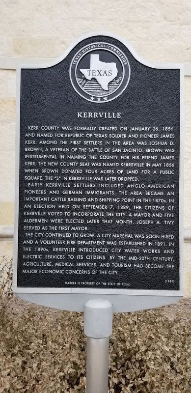
1. Kerrville Marker
Kerr County was formally created on January 26, 1856, and named for Republic of Texas soldier and pioneer James Kerr. Among the first settlers in the area was Joshua D. Brown, a veteran of the Battle of San Jacinto. Brown was instrumental in naming the county for his friend James Kerr. The new county seat was named Kerrsville in May 1856 when Brown donated four acres of land for a public square. The "S" in Kerrsville was later dropped.
Early Kerrville settlers included Anglo-American pioneers and German immigrants. The area became an important cattle raising and shipping point in the 1870s. In an election held on September 7, 1889, the citizens of Kerrville voted to incorporate the city, and a mayor and five aldermen were elected later that month. Joseph A. Tivy served as first mayor.
The town continued to grow. A City Marshal was soon hired and a volunteer fire department was established in 1891. In the 1890s, Kerrville introduced city water works and electric services to its citizens. By the mid-20th century, agriculture, medical services, and tourism had become the major economic concerns of the city.
Marker is property of the State of Texas
Erected 1989 by Texas Historical Commission. (Marker Number 2932.)
Topics. This historical marker is listed in these topic lists: Industry & Commerce • Settlements & Settlers • War, Texas Independence. A significant historical date for this entry is January 26, 1856.
Location. 30° 2.817′ N, 99° 8.439′ W. Marker is in Kerrville, Texas, in Kerr County. It can be reached from the intersection of Main Street and Sidney Backer Street (State Highway 16). Located in front of Kerrville City Hall. Touch for map. Marker is at or near this postal address: 701 Main Street, Kerrville TX 78028, United States of America. Touch for directions.

Regionally, this marker is in the Hill
this page online
Other nearby markers. At least 8 other markers are within walking distance of this marker: Joshua D. Brown (within shouting distance of this marker); Charles A. Schreiner (within shouting distance of this marker); The Schreiner Building (within shouting distance of this marker); Schreiner's Roses (about 300 feet away, measured in a direct line); Floyd A. Cailloux (about 300 feet away); Sid Peterson (about 300 feet away); Old Kerrville Post Office (1936) (about 300 feet away); Captain Charles Schreiner Home (about 300 feet away). Touch for a list and map of all markers in Kerrville.
Also see . . . James Kerr (1790–1850). The Handbook of Texas (Submitted on December 12, 2020, by James Hulse of Medina, Texas.)

Photographed by James Hulse, December 5, 2020
2. Kerrville City Hall and Marker
Credits. This page was last revised on March 6, 2026. It was originally submitted on December 12, 2020, by James Hulse of Medina, Texas. This page has been viewed 482 times since then and 35 times this year. Photos: 1, 2. submitted on December 13, 2020, by James Hulse of Medina, Texas. • J. Makali Bruton was the editor who published this page.
