Mineral del Chico, Hidalgo, Mexico — The Central Highlands (North America)
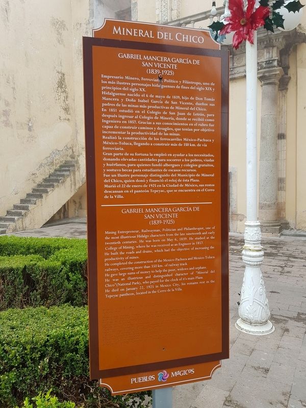
Gabriel Mancera García de Vicente
Mineral del Chico
Gabriel Mancera García de Vicente
(1839-1925)
Empresario Minero, Ferroviario, Político y Filántropo, uno de los más ilustres personajes hidalguenses de fines del siglo XIX y principios del siglo XX.
Hidalguense nacido el 6 de mayo de 1839, hijo de Don Tomás Mancera y Doña Isabel García de San Vicente, dueños sus padres de las minas más productivas de Mineral del Chico. En 1851 estudió en el Colegio de San Juan de Letran, para después ingresar al Colegio de Minería, donde se recibió como Ingeniero en 1857. Gracias a sus conocimientos en el rubro fue capaz de construir caminos y desagües, que tenían por objetivo incrementar la productividad de las minas.
Realizó la construcción de los ferrocarriles México-Pachuca y México-Toluca, llegando a construir más de 350 km. de vía ferroviaria.
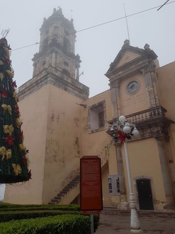
Gran parte de su fortuna la empleó en ayudar a los necesitados, donando elevadas cantidades para socorrer a los pobres, viudas y huérfanos, para quienes fundó albergues y colegios gratuitos, y sostuvo becas para estudiantes de escasos recursos. Fue un Ilustre personaje distinguido del Municipio de Mineral del Chico, quien donó y financió el reloj de ésta Plaza. Murió el 22 de enero de 1925 en la Ciudad de México, sus restos descansan en el panteón Tepeyac, que se encuentra en el Cerro de la Villa.
Gabriel Mancera García de Vicente
(1839-1925)
Mining Entrepreneur, Railwayman, Politician and Philanthropist, one of the most illustrious Hidalgo characters from the late nineteenth and early twentieth centuries.
He was born on May 6, 1839. He studied at the College of Mining, where he was received as an Engineer in 1857. He built the roads and drains, which had the objective of increasing the productivity of mines.
He completed the construction of the Mexico Pachuca and Mexico-Toluca railways, covering more than 350 km, of railway track.
He gave large sums of money to help the poor, widows and orphans. He was an illustrious and distinguished character of "Mineral del Chico"(National Park), who payed for the clock of it's main Plaza He died on January 22, 1925 in Mexico City, his remains rest in the Tepeyac pantheon, located in the Cerro de la Villa.
Topics. This historical marker is listed in these topic lists: Charity & Public Work • Industry & Commerce • Railroads & Streetcars. A significant historical date for this entry is January 22, 1925.
Location. 20° 12.933′
N, 98° 43.848′ W. Marker is in Mineral del Chico, Hidalgo. Marker is on General Alfonso Corona del Rosal just north of Calle Gabriel Mancera, on the right when traveling north. Touch for map. Marker is in this post office area: Mineral del Chico HGO 42120, Mexico. Touch for directions.
Other nearby markers. At least 8 other markers are within 11 kilometers of this marker, measured as the crow flies. The Mineral del Chico Clock Mechanism (a few steps from this marker); Electrification in Mineral del Chico (a few steps from this marker); Church of the Immaculate Conception (within shouting distance of this marker); Gabriela Mistral in Mineral del Chico (within shouting distance of this marker); Las Monjas Peaks (within shouting distance of this marker); 19th Century House (City Hall) (within shouting distance of this marker); Coronel José María Pérez (approx. 9.9 kilometers away); Benito Juárez (approx. 10 kilometers away). Touch for a list and map of all markers in Mineral del Chico.
Credits. This page was last revised on December 15, 2020. It was originally submitted on December 15, 2020, by J. Makali Bruton of Accra, Ghana. This page has been viewed 89 times since then and 12 times this year. Photos: 1, 2. submitted on December 15, 2020, by J. Makali Bruton of Accra, Ghana.

