Bloomsburg in Columbia County, Pennsylvania — The American Northeast (Mid-Atlantic)
Rupert Covered Bridge
A Popular Route for Travelers
The Battered Bridge
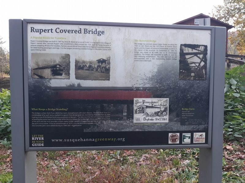
The bridge has survived several major floods including the 1904 Ice Jam Flood and the 1972 Flood of Tropical Storm Agnes and the impact of numerous automobile accidents in the interior of the structure. On September 22, 1994 the bridge was closed to all traffic due to its deteriorated condition. The bridge was reopened to traffic on June 25, 2001 following rehabilitation. The walls and roof are still self-supported, with a new load-bearing modern bridge constructed underneath.
What Keeps a Bridge Standing?
The bridge is a Burr Arch Truss which has been strengthened with steel l-Beams. The Burr Arch Truss is a combination of an arch and a multiple kingpost truss design and was invented by Theodore Burr in 1804 making it one of the earliest and most prominent of designs. The idea was that the arch should be capable of bearing the entire load on the bridge while the truss keeps the bridge rigid. Either way, the combination of the arch and the truss provides a more stable bridge capable of supporting greater weight than either the arch or truss alone. It has an overall length of 185 ft., 4 inches and was originally a one-span bridge until two concrete piers were added during its 1999-2001 rehabilitation.
Bridge Facts
Rupert Bridge, 1963
Year Built: 1847
Waterway: Fishing Creek
Builder: Jesse M. Beard
Truss: Burr
Erected by The Theodore Burr Covered Bridge Society.
Topics and series. This historical marker is listed in this topic list: Bridges & Viaducts. In addition, it is included in the Covered Bridges, and the National Register of Historic Places series lists. A significant historical date for this entry is June 25, 2001.
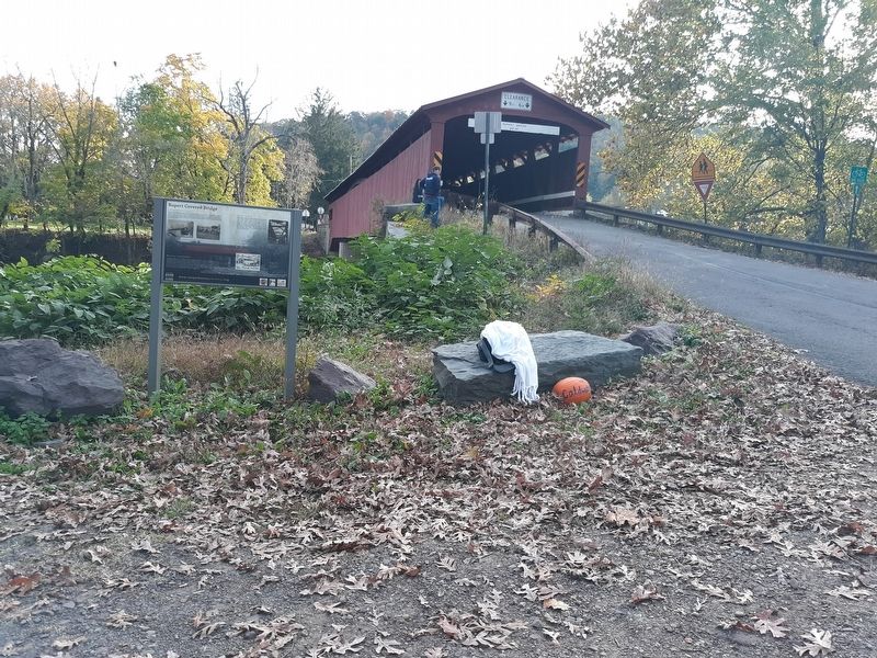
Location. 40° 58.904′ N, 76° 28.34′ W. Marker is in Bloomsburg, Pennsylvania, in Columbia County. Marker is on Covered Bridge Road, on the right when traveling north. Touch for map. Marker is in this post office area: Bloomsburg PA 17815, United States of America. Touch for directions.
Other nearby markers. At least 8 other markers are within 2 miles of this marker, measured as the crow flies. A different marker also named Rupert Covered Bridge (within shouting distance of this marker); Native American Inhabitants Memorial (approx. 0.4 miles away); Fort McClure (approx. 0.9 miles away); Wyoming Path (approx. 0.9 miles away); Replica of the Statue of Liberty (approx. 1˝ miles away); 261 West Main Street (approx. 1˝ miles away); 246 West Main Street (approx. 1˝ miles away); 259 West Main Street (approx. 1˝ miles away). Touch for a list and map of all markers in Bloomsburg.
Related marker. Click here for another marker that is related to this marker.
Also see . . . Rupert Covered Bridge. (Submitted on December 29, 2020, by Craig Doda of Napoleon, Ohio.)
Credits. This page was last revised on December 8, 2023. It was originally submitted on December 29, 2020, by Craig Doda of Napoleon, Ohio. This page has been viewed 110 times since then and 19 times this year. Photos: 1, 2, 3. submitted on December 29, 2020, by Craig Doda of Napoleon, Ohio. • Bill Pfingsten was the editor who published this page.


