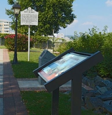
Havre de Grace in Harford County, Maryland — The American Northeast (Mid-Atlantic)
British Landing
Star-Spangled Banner National Historic Trail
The town's defenders -- numbering about 20 -- failed to prevent some 400 British troops from coming ashore May 3, 1813.
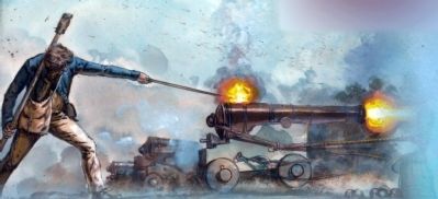
A gun battery, probably located north of where the lighthouse now stands, was manned single-handedly by John O'Neill for a short time. He was later caught with two muskets and imprisoned on a British ship for several days.
"I observed Guns fired and American Colours hoisted at a battery lately erected at Havre-de-Grace...[we] opened [fire] on the Place...which was smartly returned from the Battery for a short time..." - British Rear Admiral George Cockburn, May 3, 1813.
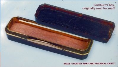
Cockburn's box, originally used for snuff
image / courtesy Maryland Historical Society
[further left, at plaque bottom] images / (C) Gerry Embleton
Erected by National Park Service / U.S. Department of the Interior.
Topics and series. This historical marker is listed in this topic list: War of 1812. In addition, it is included in the Star Spangled Banner National Historic Trail series list. A significant historical date for this entry is May 3, 1813.
Location. 39° 32.432′ N, 76° 5.077′ W. Marker is in Havre de Grace, Maryland, in Harford County. Marker can be reached from the intersection of Lafayette Street and Concord Street. The marker is along the water front walk near Concord Point Lighthouse. Touch for map. Marker is in this post office area: Havre de Grace MD 21078, United States of America. Touch for directions.
Other nearby markers. At least 8 other markers are within walking distance of this marker. The point where the Susquehanna River meets the Chesapeake Bay (here, next to this marker); Dangerous Waters (a few steps from this marker); John O'Neill (a few steps from this marker); Principio Destroyed (within shouting distance of this marker); Concord Point Light Station (within shouting distance of this marker); The Concord Point Light Keeper’s House and Property, 1827-1920 (within shouting distance of this marker); Havre de Grace (within shouting distance of this marker); Keeper of the Light (within shouting distance of this marker). Touch for a list and map of all markers in Havre de Grace.
Also see . . . John O'Neil, The Hero of Havre De Grace. Concord Point Lighthouse website entry (Submitted on March 3, 2022, by Larry Gertner of New York, New York.)
Photographed By Allen C. Browne, October 4, 2013
4. Family Trait
O'Neill's 15-year-old daughter, Matilda, reportedly helped negotiate her father's release. Tradition holds that British Rear Admiral Cockburn was so impressed with the young girl's bravery he gave her a tortoise-shell box.Close-up of image on marker
Maryland Historical Society
Maryland Historical Society
Photographed By Allen C. Browne, September 5, 2015
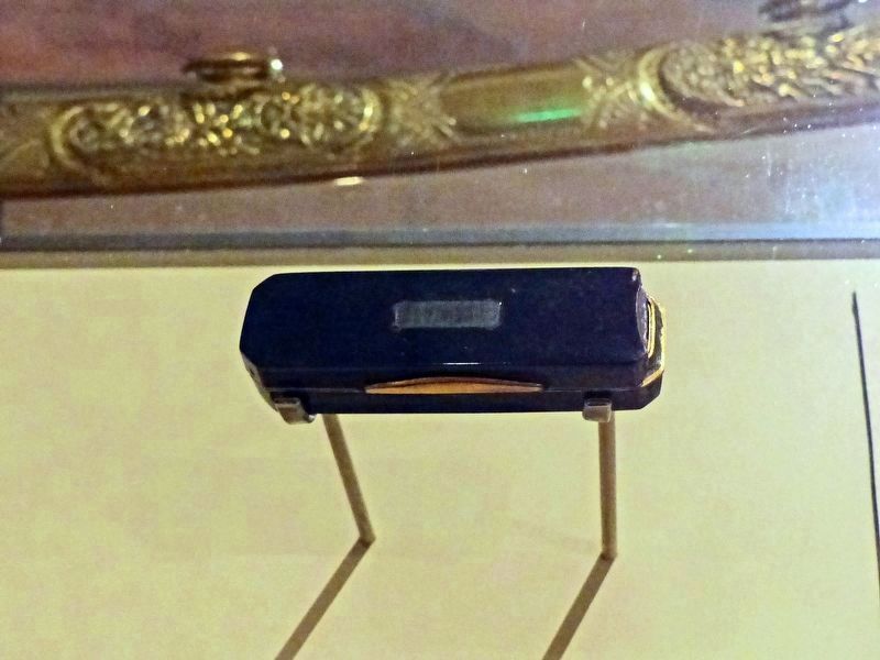
5. Box
In the Maryland Historical Society Museum
In the Maryland Historical Society Museum
“According to legend, Matilda O'Neill (1796-1867) recieved this tortoise shell box from British Admiral Sir George Cockburn (1772-1853) aboard H.M.S. frigate Maidstone, where her father, John O'Neill (1768-1838) was being held prisoner. Cockburn is said to have given it to her as reward for her bravery when she negotiated with a town delegation for her father's release.” — Maryland Historical Society

Photographed By Allen C. Browne, September 5, 2015
6. Presentation Sword
In the Maryland Historical Society Museum
In the Maryland Historical Society Museum
Several gentlemen of Philadelphia gave this presentation sword to John O'Neill (1768-1838) as a token of respect after his single-handed attempt to defend Havre de Grace from a British Raid.…inscribed ’Presented to the Gallant O'Neill for his valor at Havre de Grace by Philadelphians 1813‘“ — Maryland Historical Society
Photographed By Allen C. Browne, October 4, 2013
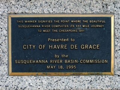
7. The Mouth of the Susquehanna
A nearby marker indicates that this spot sits near the mouth of the Susquehanna River where the river debouches into the Chesapeake Bay, its sunken estuary.
This marker signifies the point where the beautiful Susquehanna River completes its 444 mile journey to meet the Chesapeake Bay
Presented to City of Havre de Grace by the Susquehanna River Basin Commission May 18, 1995.
This marker signifies the point where the beautiful Susquehanna River completes its 444 mile journey to meet the Chesapeake Bay
Presented to City of Havre de Grace by the Susquehanna River Basin Commission May 18, 1995.
Credits. This page was last revised on July 26, 2022. It was originally submitted on October 11, 2013, by Allen C. Browne of Silver Spring, Maryland. This page has been viewed 626 times since then and 13 times this year. Last updated on December 29, 2020, by Carl Gordon Moore Jr. of North East, Maryland. Photos: 1, 2, 3, 4. submitted on October 11, 2013, by Allen C. Browne of Silver Spring, Maryland. 5, 6. submitted on December 18, 2016, by Allen C. Browne of Silver Spring, Maryland. 7. submitted on October 11, 2013, by Allen C. Browne of Silver Spring, Maryland. • Bill Pfingsten was the editor who published this page.
