Walnut Hills in Cincinnati in Hamilton County, Ohio — The American Midwest (Great Lakes)
Peebles Corner
Photographed by Allen W. Bernard, November 29, 2020
1. Peebles Corner Marker
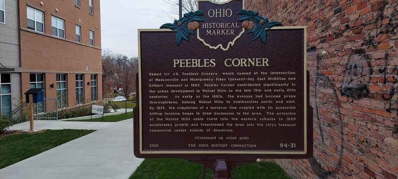
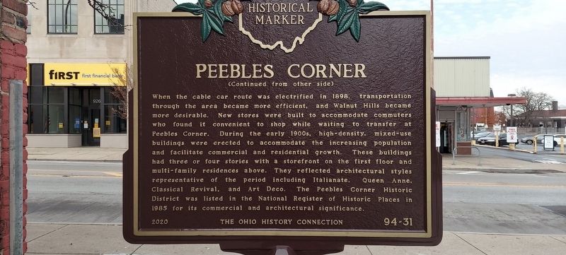
Named for J.R. Peebles's Grocery, which opened at the intersection of Madisonville and Montgomery Pikes (present-day East McMillan and Gilbert Avenues) in 1883, Peebles Corner contributed significantly to the urban development in Walnut Hills in the late 19th and early 20th centuries. As early as the 1860s, the avenues had become prime thoroughfares, linking Walnut Hills to communities north and east. By 1872, the completion of a horsecar line coupled with its accessible hilltop location began to draw businesses to the area. The extension of the Walnut Hills cable route into the eastern suburbs in 1885 accelerated growth and transformed the area into the city's foremost commercial center outside of downtown.
When the cable car route was electrified in 1898, transportation through the area became more efficient, and Walnut Hills became more desirable. New sotres were built to accommodate commuters who found it convenient to shop while waiting to transfer at Peebles Corner. During the early 1900s, high-density, mixed use buildings were erected to accommodate the increasing population and facilitate commercial and residential
this page online
Erected 2020 by The Ohio History Connection. (Marker Number 94-31.)
Topics and series. This historical marker is listed in these topic lists: Architecture • Industry & Commerce • Railroads & Streetcars • Settlements & Settlers. In addition, it is included in the Art Deco, and the Ohio Historical Society / The Ohio History Connection series lists. A significant historical year for this entry is 1883.
Location. 39° 7.548′ N, 84° 29.331′ W. Marker is in Cincinnati, Ohio, in Hamilton County. It is in Walnut Hills. It is on East McMillan Street just east of St. James Avenue, on the right when traveling south. Touch for map. Marker is at or near this postal address: 951 E McMillan St, Cincinnati OH 45206, United States of
Photographed by Allen W. Bernard, November 29, 2020
2. Peebles Corner Marker

Regionally, this marker is in the American Midwest and in the Ohio River Valley. Globally, it is in North America, the Western Hemisphere, the Western World, and the Anglosphere. Historically, it finds itself in what was once the Haudenosaunee (Iroquois) Confederacy, the territory of the Mississippian Culture, and the Northwest Territory.
Other nearby markers. At least 8 other markers are within walking distance of this marker: The Verona (approx. 0.2 miles away); Lane Theological Seminary / The Lane Seminary Debates (approx. 0.3 miles away); Manse Hotel and Annex / Horace Sudduth (approx. 0.4 miles away); Votes for Women (approx. 0.4 miles away); Cincinnati Federation of Colored Women’s Clubs / Cincinnati Federation Clubhouse (approx. 0.4 miles away); Harriet Beecher Stowe House (approx. half a mile away); Harriet Beecher Stowe (approx. half a mile away); Cincinnati Ford Assembly Plant (approx. half a mile away). Touch for a list and map of all markers in Cincinnati.
More about this marker. Marker is in the middle of a block and there are not street numbers
Regarding Peebles Corner. Peebles
Photographed by Allen W. Bernard, November 29, 2020
3. Peebles Corner Marker
Credits. This page was last revised on February 4, 2023. It was originally submitted on January 4, 2021, by Allen W. Bernard of Cincinnati, Oh 45202-1736. This page has been viewed 1,790 times since then and 147 times this year. Photos: 1, 2, 3. submitted on January 4, 2021, by Allen W. Bernard of Cincinnati, Oh 45202-1736. • Devry Becker Jones was the editor who published this page.
