Westwood in Cincinnati in Hamilton County, Ohio — The American Midwest (Great Lakes)
The Village of Westwood
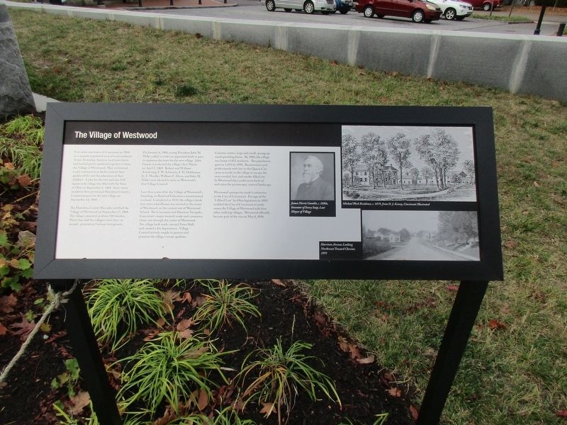
Five Miles northwest of Cincinnati in 1868, in a sparsely populated area of southeast Green Township, farmers, local merchants, and landed gentry gathered together to form the Village of Westwood. They envisioned a new community to better control their quality of life and the education of their children. A plat for the two and one-half square mile village was fled with the State of Ohio on September 6, 1868. Sixty-seven residents then petitioned Hamilton County’s Commissioners for the new village on September 14, 1868.
The Hamilton County Recorder certified the Village of Westwood on September 17, 1868. The village consisted of about 100 families. More then half the villagers were first-or second-generation German immigrants.
On January 6, 1896, acting President John M. Miller called to order an appointed body in part to organize elections for the new village. John Gaines was elected the village’s first Mayor on April 5, 1869. Robert and William Armstrong, F.W. Schwartz, F.H. Ochlmann,, Jr.,F. Mueller, William F. Davis and John M. Miller were elected to serve as Westwood’s first Village Council.
Less than a year after the Village of Westwood’s founding, it’s first Board of education commissioned a school. Completed in 1870, the village’s brick two-story schoolhouse was erected in the center of Westwood, on the current site of Westwood School. The Cincinnati and Hamilton turnpike, Cincinnati’s major westerly trade and commerce route, ran through the center of Westwood. The village built roads, erected Town Hall, and created a fire department. Village Council actively sought to protect and promote the village’s scenic qualities.
Country estates, large and small, sprang up amid sprawling farms. By 1880, the village was home to 852 residents. The population grew to 1,052 by1890. Businessmen and professionals with ties to the Queen City came to reside in the village to escape the overcrowded, hot, smoke-filled city. In Westwood they could savor fresh air and enjoy the picturesque, natural landscape.
Westwood’s prosperity made it attractive to the City of Cincinnati. Passage of the :Lillard Law’ by Ohio legislators in 1893 enabled the City of Cincinnati to easily annex the Village of Westwood with four other outlying villages. Westwood officially became part of the city on May 8, 1896.
Erected 2019.
Topics. This historical marker is listed in this topic list: Settlements & Settlers. A significant historical date for this entry is September 6, 1868.
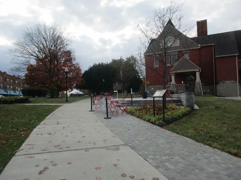
Location. 39° 8.949′ N, 84° 35.956′ W. Marker is in Cincinnati, Ohio, in Hamilton County. It is in Westwood. Marker is at the intersection of Harrison Avenue and Montana Avenue, on the right when traveling south on Harrison Avenue. The marker is on the grounds of the Westwood Town Hall. Touch for map. Marker is at or near this postal address: 3017 Harrison Ave, Cincinnati OH 45211, United States of America. Touch for directions.
Other nearby markers. At least 8 other markers are within 4 miles of this marker, measured as the crow flies. James Norris Gamble (a few steps from this marker); Historic Westwood Town Hall (a few steps from this marker); Westwood Veterans Memorial (within shouting distance of this marker); Enoch Terry Carson (approx. 0.9 miles away); The Origins of Harvest Home (approx. 0.9 miles away); Powhatan Beaty / Union Baptist Cemetery (approx. 2.3 miles away); Mt. Airy Forest (approx. 2.7 miles away); Camp Washington World War Memorial (approx. 3.3 miles away). Touch for a list and map of all markers in Cincinnati.
Credits. This page was last revised on February 9, 2023. It was originally submitted on January 6, 2021, by Rev. Ronald Irick of West Liberty, Ohio. This page has been viewed 202 times since then and 42 times this year. Photos: 1, 2. submitted on January 6, 2021, by Rev. Ronald Irick of West Liberty, Ohio. • Devry Becker Jones was the editor who published this page.

