Casper in Natrona County, Wyoming — The American West (Mountains)
Pony Express
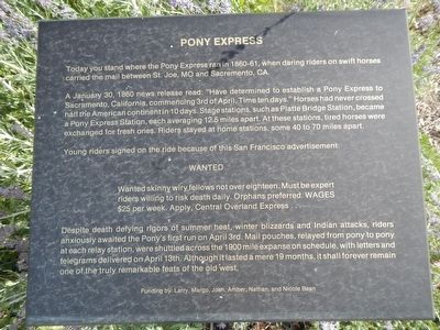
A January 30, 1860 news release read: “Have determined to establish a Pony Express to Sacramento, California, commencing 3rd of April. Time ten days.” Horses had never crossed half the American continent in ten days. Stage stations, such as Platte Bridge Station, became a Pony Express Station, each averaging 12.5 miles apart. At these stations, tired horses were exchanged for fresh ones. Riders stayed at home stations, some 40 to 70 miles apart.
Young riders signed on the ride because of this San Francisco advertisement:
Wanted skinny wiry fellows not over eighteen. Must be expert riders willing to risk death daily. Orphans preferred. WAGES $25 per week. Apply, Central Overland Express….
Despite death defying rigors of summer heat, winter blizzards and Indian attacks, riders anxiously awaited the Pony’s first run on April 3rd. Mail pouches, relayed from pony to pony at each relay station, were shuttled across the 1900 mile expanse on schedule, with letters and telegrams delivered on April 13th. Although it lasted a mere 19 months, it shall forever remain one of the truly remarkable feats of the old west.
Erected by Natrona County Historical Society.
Topics and series. This historical marker is listed in this topic list: Communications. In addition, it is included in the Pony Express National Historic Trail series list.
Location. 42° 50.171′ N, 106° 22.321′ W. Marker is in Casper, Wyoming, in Natrona County. Marker can be reached from Fort Caspar Road, 0.1 miles west of Wyoming Route 258, on the right when traveling west. Touch for map. Marker is at or near this postal address: 4001 Fort Caspar Road, Casper WY 82604, United States of America. Touch for directions.
Other nearby markers. At least 8 other markers are within walking distance of this marker. Richard Bridge and Military Complex (here, next to this marker); Bridger and Bozeman Trails (here, next to this marker); Ranching in Wyoming (here, next to this marker); The Mormons (here, next to this marker); Goose Egg Ranch (a few steps from this marker); Oregon/California/Mormon Trails (a few steps from this marker); Military Explorers (a few steps from this marker); Ellen L. Watson (“Cattle Kate”) (a few steps from this marker). Touch for a list and map of all markers in Casper.
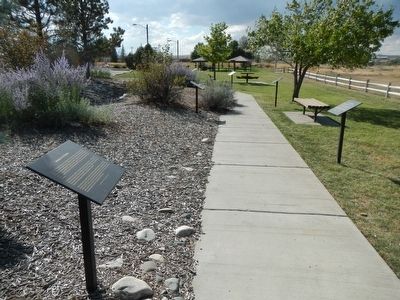
More about this marker. This marker is part of the Wyoming history walk in Centennial Park, which is adjacent to the Fort Caspar Museum and shares the parking lot.
Credits. This page was last revised on January 12, 2021. It was originally submitted on December 25, 2015, by Barry Swackhamer of Brentwood, California. This page has been viewed 531 times since then and 22 times this year. Last updated on January 12, 2021, by Craig Baker of Sylmar, California. Photos: 1, 2. submitted on December 25, 2015, by Barry Swackhamer of Brentwood, California.

