Near Hilldale in Summers County, West Virginia — The American South (Appalachia)
Concrete & Cut Stone Foundations
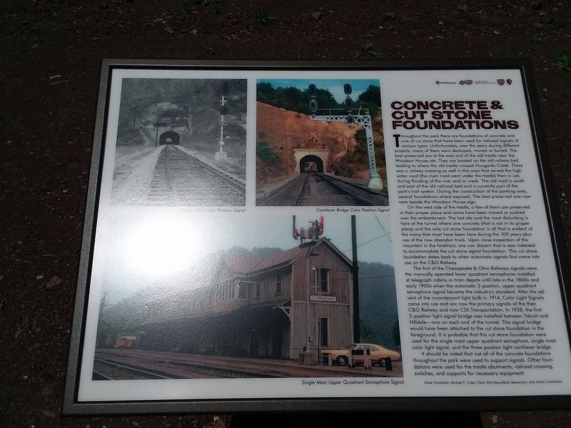
Throughout the park there are foundations of concrete and one of cut stone that have been used for railroad signals of various types. Unfortunately, over the years during different projects, many of them were destroyed, moved or buried. The best preserved are at the east end of the old trestle near the Woodson House site. They are located on the old railway bed leading to where the old trestle crossed Hungards Creek. There was a railway crossing as well in this area that served the high water road (the main road went under the trestle) then in use during flooding of the river and or creek. The old road is south and east of the old railroad bed and is currently part of the park's trail system. During the construction of the parking area, several foundations where exposed. The best preserved one now rests beside the Woodson House sign.
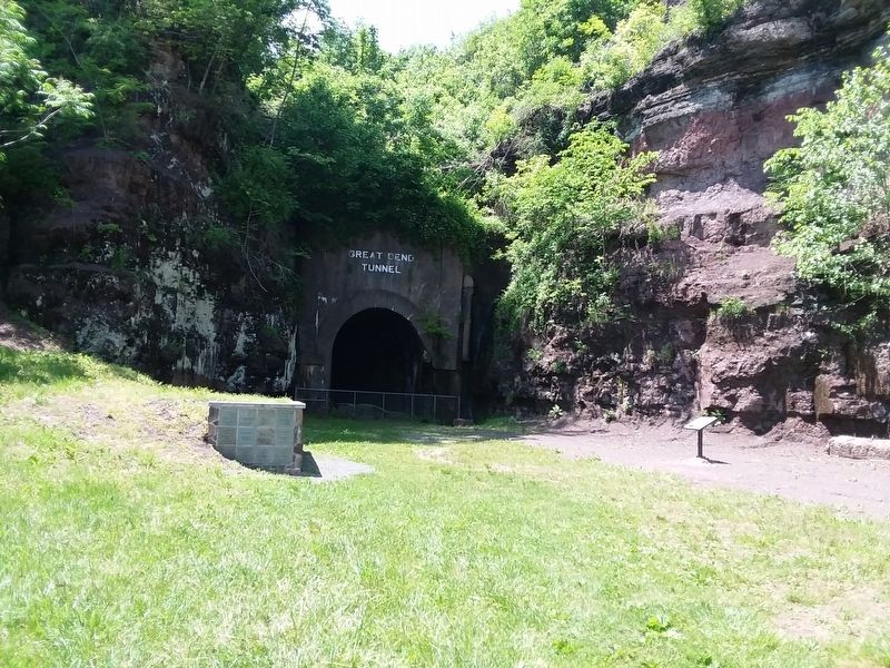
On the west side of the trestle, a few of them are preserved in their proper place and some have been moved or pushed over the embankment. The last site and the most disturbing is here at the tunnel where one concrete (that is not in its proper place) and the only cut stone foundation is all that is evident of the many that must have been here during the 100 years plus use of the now abandon track. Upon close inspection of the mountain in the forefront, one can discern that is was indented to accommodate the cut stone signal foundation. This cut stone foundation dates back to when automatic signals first came into use on the C&O Railway.
The first of the Chesapeake & Ohio Railways signals were the manually operated lower quadrant semaphores installed at telegraph cabins or train depots until late in the 1800s and early 1900s when the automatic 3-position, upper-quadrant semaphore signal became the industry's standard. After the advent of the incandescent light bulb in 1914, Color Light Signals came into use and are now the primary signals of the then C&O Railway and now CSX Transportation. In 1928, the first 3-position light signal bridge was installed between Talcott and Hilldale-one on each end of the tunnel. This signal bridge would have been attached to the cut stone foundation in the foreground. It is probable that this cut stone foundation were used for the single mast upper quadrant semaphore, single mast color light signal, and the three position light cantilever bridge.
It should be noted that not all of the concrete foundations throughout the park were used to support signals. Other foundations were used for the trestle abutments, railroad crossing, switches, and supports for necessary equipment.
Erected by John Kesler.
Topics. This historical marker is listed in these topic lists: Architecture • Railroads & Streetcars. A significant historical year for this entry is 1914.
Location. 37° 38.977′ N, 80° 46.021′ W. Marker is near Hilldale, West Virginia, in Summers County. Marker is on West Virginia Route 3/12, 0.2 miles north of Huston, on the right when traveling east. On the grounds of the John Henry Historical Park. Touch for map. Marker is at or near this postal address: 243 State Hwy 3, Hinton WV 25951, United States of America. Touch for directions.
Other nearby markers. At least 8 other markers are within walking distance of this marker. The Legend Of John Henry (here, next to this marker); John Henry (a few steps from this marker); John Henry In Fiction (within shouting distance of this marker); Great Bend Tunnel Construction (within shouting distance of this marker); Tunnel Construction Technology Improves (within shouting distance of this marker); Great Bend Tunnel (about 300 feet away, measured in a direct line); Why The Tunnel Was Built (about 300 feet away); a different marker also named Great Bend Tunnel (about 300 feet away).
Credits. This page was last revised on December 4, 2022. It was originally submitted on January 20, 2021, by Craig Doda of Napoleon, Ohio. This page has been viewed 167 times since then and 30 times this year. Last updated on December 3, 2022, by Bradley Owen of Morgantown, West Virginia. Photos: 1, 2, 3, 4. submitted on January 20, 2021, by Craig Doda of Napoleon, Ohio. • Devry Becker Jones was the editor who published this page.


