
Near Worden in Yellowstone County, Montana — The American West (Mountains)
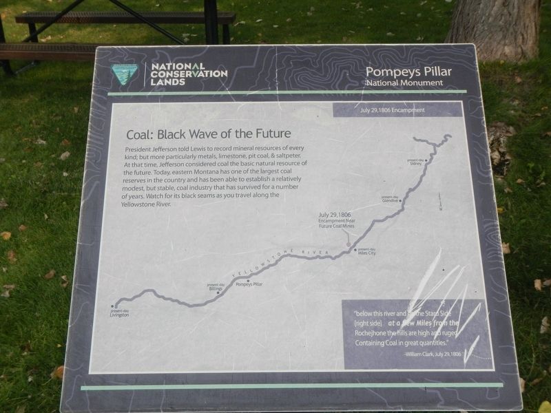
Coal: Black Wave of the Future
July 29, 1806 Encampment
Photographed by Barry Swackhamer, September 14, 2020
1. Coal: Black Wave of the Future Marker
"below this river on the Stard Side (right side) at a few Miles from the Rochejhone the hills are high and ruged Containing Coal in great quantities. - William Clark, July 29, 1806
Erected by Bureau of Land Management and National Conservation Lands.
Topics and series. This historical marker is listed in these topic lists: Exploration • Natural Resources. In addition, it is included in the Lewis & Clark Expedition series list. A significant historical date for this entry is July 29, 1806.
Location. 45° 59.661′ N, 108° 0.086′ W. Marker is near Worden, Montana, in Yellowstone County. It can be reached from State Highway 312 near South 31st Road,
this page online

Regionally, this marker is in Yellowstone Country and in Greater Billings. It is also in the American Mountain West and in the Lewis & Clark Corridor. Globally, it is in North America, the Western Hemisphere, the Western World, and the Anglosphere. Historically, it finds itself in what was once Rupert’s Land and also the Louisiana Purchase.
Other nearby markers. At least 8 other markers are within walking distance of this marker: A Good Home (a few steps from this marker); Buffalo: Then and Now (a few steps from this marker); Open Spaces: Room to Roam (within shouting distance of this marker); The "Yellowstone River" Walkway (within shouting distance of this marker); Triumph and Torment (within shouting distance of this marker); Sign of American Indians (about 300 feet away, measured in a direct line); Making Canoes, Then and Now (about 300 feet away); Clark's Canoe Camp on the Yellowstone, Archaeology Study (about 400 feet away). Touch for a list and map of all markers in Worden.
Credits. This page was last revised on January 25, 2021. It was originally submitted on January 25, 2021, by Barry Swackhamer of Brentwood, California. This page has been viewed 209 times since then and 20 times this year. Photo 1. submitted on January 25, 2021, by Barry Swackhamer of Brentwood, California.
Editor’s want-list for this marker. Mid-distance view of the marker. • Can you help?
