CH-54 Tarhe
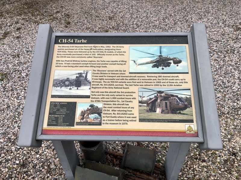
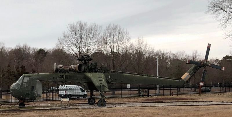
The Sikorsky S-64 Skycrane first took flight in May, 1962. The US Army quickly purchased six of the heavy lift helicopters, designating them YCH-54As. These were followed up by the CH-54A/B models, of which the Army eventually purchased a total of 105. Officially known as the Tarhe, the CH-54 was more commonly called 'Skycrane'.
With two Pratt & Whitney turbine engines, the Tarhe was capable of lifting 10 tons. It had a standard cockpit forward and another cockpit facing aft which is a rear-facing pilot used when lifting large loads.
The 'Skycrane' served with the 1st Cavalry Division in Vietnam where it was used for transport and downed-aircraft recovery. Retrieving 380 downed aircraft, it was highly successful and with the addition of a removable pod, the CH-54 could carry up to 45 troops. The six YCH-54 variants were first sent to Vietnam in 1965 and of those six, only this aircraft, No. 64-14203, survived. The last Tarhe was retired in 1993 by the 113th Aviation Regiment of the Army National Guard.
Not only was this aircraft the 3rd production Tarhe and the only early variant to survive Vietnam, with over
this page online
Erected by US Army Transportation Museum.
Topics. This historical marker is listed in these topic lists: Air & Space • War, Vietnam. A significant historical month for this entry is May 1962.
Location. 37° 9.848′ N, 76° 34.602′ W. Marker is in Newport News, Virginia. It is in Fort Eustis. It can be reached from the intersection of Washington Boulevard and Jefferson Avenue, on the right when traveling north. Touch for map. Marker is at or near this postal address: 321 Washington Blvd, Fort Eustis VA 23604, United States of America. Touch for directions.

Regionally, this marker is on Virginia’s Peninsula, in Hampton Roads, in Coastal Virginia, and in the Hampton Roads Metropolitan Area. It is also in the American South, specifically in the Upper South, in the Tidewater, and on the Eastern Seaboard. Globally, it is in the North Atlantic Region, North America,
Other nearby markers. At least 8 other markers are within walking distance of this marker: GEM, Model 2500 Air Car (a few steps from this marker); U-6A Beaver (a few steps from this marker); H-25A Mule (a few steps from this marker); Airgeep II VZ-8P (B) (a few steps from this marker); Doak 16 VZ-4DA (within shouting distance of this marker); U-1A Otter (within shouting distance of this marker); UH-1H Iroquois (within shouting distance of this marker); CH-37 Mojave (within shouting distance of this marker). Touch for a list and map of all markers in Newport News.
Credits. This page was last revised on February 1, 2023. It was originally submitted on February 28, 2021, by Devry Becker Jones of Washington, District of Columbia. This page has been viewed 869 times since then and 83 times this year. Photos: 1, 2. submitted on February 28, 2021, by Devry Becker Jones of Washington, District of Columbia.
