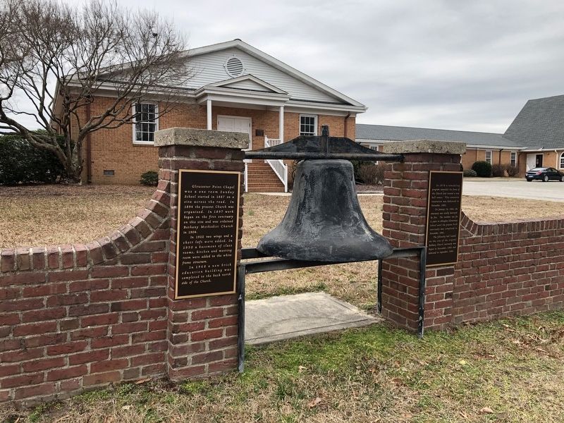
Gloucester Point Chapel
![Gloucester Point Chapel Marker [Left plaque]. Click for full size. Gloucester Point Chapel Marker [Left plaque] image. Click for full size.](Photos5/571/Photo571300.jpg?312021111100PM)
Gloucester Point Chapel was a one room Sunday School started in 1887 on a site across the road. In 1894 the present Church was organized. In 1897 work began on the first sanctuary on this site and was ordained Bethany Methodist Church in 1904.
In 1922 two wings and a choir loft were added. In 1950 a basement of class rooms, kitchen and meeting room were added to the white frame structure.
In 1968 a new brick education building was completed to the back north side of the Church.
In 1978 a remodeling program extended the front of the Church and created a new bell tower. This extensive renovation was dedicated in November, 1980.
On January 16, 1982, the sanctuary was totally destroyed by fire. The members met for 2 years at Abingdon Elementary School until the present brick sanctuary was completed in November, 1983.
The fellowship hall located on the site of the original Bethany Church sanctuary was begun in November, 1983 and dedicated in September, 1984.
Erected by Bethany United Methodist Church.
Topics. This historical marker is listed in these topic lists: Churches & Religion • Education. A significant historical date for this entry is January 16, 1982.
Location. 37° 15.772′ N, 76° 29.706′ W. Marker is in Gloucester Point
Other nearby markers. At least 8 other markers are within walking distance of this marker. 1920's Farm Equipment (approx. 0.2 miles away); 1953 Benthall Peanut Picker (approx. ¼ mile away); The British Safety Valve (approx. 0.9 miles away); A Vital British Outpost at Gloucester Point (approx. 0.9 miles away); Parts of a Parrott Rifle (approx. 0.9 miles away); Natives, Explorers, Tobacco and Buccaneers (approx. 0.9 miles away); After the Surrender at Yorktown (approx. 0.9 miles away); On to Richmond! (approx. 0.9 miles away). Touch for a list and map of all markers in Gloucester Point.
![Gloucester Point Chapel Marker [Right plaque]. Click for full size. Gloucester Point Chapel Marker [Right plaque] image. Click for full size.](Photos5/571/Photo571301.jpg?312021111200PM)

Credits. This page was last revised on March 1, 2021. It was originally submitted on March 1, 2021, by Devry Becker Jones of Washington, District of Columbia. This page has been viewed 99 times since then and 9 times this year. Photos: 1, 2, 3. submitted on March 1, 2021, by Devry Becker Jones of Washington, District of Columbia.