Talihina in Le Flore County, Oklahoma — The American South (West South Central)
B-29 Crash Near Talihina
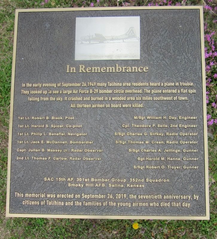
In Remembrance
In the early evening of September 26, 1949 many Talihina area residents heard a plane in trouble. They looked up to see a large Air Force B-29 bomber circle overhead. The plane entered a flat spin falling from the sky. It crashed and burned in a wooded area six miles southwest of town. All thirteen airmen on board were killed.
1st Lt. Robert B. Black, Pilot · 1st Lt. Harold S. Spicer, Co-pilot · 1st Lt. Philip L. Benefiel, Navigator · 1st Lt. Jack E. McDannell, Bombardier · Capt. Julian B. Massey Jr., Radar Observer · 2nd Lt. Thomas F. Carlow, Radar Observer · M/Sgt William H. Day, Engineer · Cpl. Theodore P. Sells, 2nd Engineer · S/Sgt Charles G. Slifkey, Radio Operator · S/Sgt Thomas M. Crean, Radio Operator · SISgt Charles A. Jellings, Gunner · Sgt Harold M. Hanna, Gunner · S/Sgt Robert O. Troyer, Gunner
SAC 15th AF, 301st Bomber Group, 352nd Squadron
Smoky Hill AFB, Salina, Kansas
This memorial was erected on September 26, 2019, the seventieth anniversary, by citizens of Talihina and the families of the young airmen who died that day.
Erected 2019.
Topics. This historical marker is listed in these topic lists: Air & Space • Disasters. A significant historical date for this entry is September 26, 1949.
Location. 34° 45.167′ N, 95° 2.924′ W. Marker is in Talihina, Oklahoma, in Le Flore County. Marker is on 1st Street east of Dallas Street, on the left when traveling east. The marker is located on the ground of the Talihina Chamber of Commerce to the left of the parking lot. Touch for map. Marker is at or near this postal address: 201 1st Street, Talihina OK 74571, United States of America. Touch for directions.
Other nearby markers. At least 7 other markers are within 10 miles of this marker, measured as the crow flies. Ft. Smith -- Ft. Towson Military Road (approx. 6.6 miles away); First Military Road (approx. 6.6 miles away); Military Road of 1832 (approx. 6.6 miles away); The Choctaw Nation (approx. 8.6 miles away); On a Clear Day (approx. 8.6 miles away); Old Lenox Mission (approx. 8.9 miles away); Deadman Vista (approx. 9.9 miles away).
Also see . . . B-29 crash near Talihina remembered. (Submitted on March 12, 2021.)
Credits. This page was last revised on March 12, 2021. It was originally submitted on March 11, 2021, by Jason Armstrong of Talihina, Oklahoma. This page has been viewed 248 times since then and 42 times this year. Photo 1. submitted on March 11, 2021, by Jason Armstrong of Talihina, Oklahoma. • J. Makali Bruton was the editor who published this page.
Editor’s want-list for this marker. A wide view photo of the marker and the surrounding area together in context. • Can you help?
