Lambertville in Hunterdon County, New Jersey — The American Northeast (Mid-Atlantic)
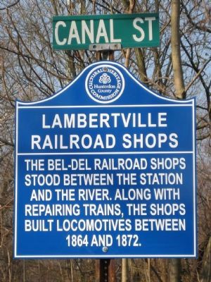
Lambertville Railroad Shops
Erected by Hunterdon County Cultural and Heritage Commission.
Topics and series. This historical marker is listed in this topic list: Railroads & Streetcars. In addition, it is included in the New Jersey, Hunterdon County Cultural and Heritage Commission series list. A significant historical year for this entry is 1864.
Location. 40° 21.739′ N, 74° 56.671′ W. Marker is in Lambertville, New Jersey, in Hunterdon County. Marker is at the intersection of Mt. Hope Street and Canal Street, on the right when traveling west on Mt. Hope Street. Touch for map. Marker is in this post office area: Lambertville NJ 08530, United States of America. Touch for directions.
Other nearby markers. At least 8 other markers are within walking distance of this marker. D & R (approx. ¼ mile away); Lambertville Railroad (approx. ¼ mile away); Road to Monmouth Battlefield (approx. ¼ mile away); Lambertville Outlet Lock (approx. ¼ mile away); Marshall House (approx. ¼ mile away); George Coryell’s Grave (approx. 0.3 miles away); Vansant House (approx. 0.3 miles away in Pennsylvania); Ferry Landing (approx. 0.3 miles away in Pennsylvania). Touch for a list and map of all markers in Lambertville.
Credits. This page was last revised on June 16, 2016. It was originally submitted on March 8, 2009, by Alan Edelson of Union Twsp., New Jersey. This page has been viewed 1,288 times since then and 30 times this year. Photo 1. submitted on March 8, 2009, by Alan Edelson of Union Twsp., New Jersey. • Kevin W. was the editor who published this page.
