Pulaski in Giles County, Tennessee — The American South (East South Central)
Establishment of Pulaski / Giles County
Inscription.
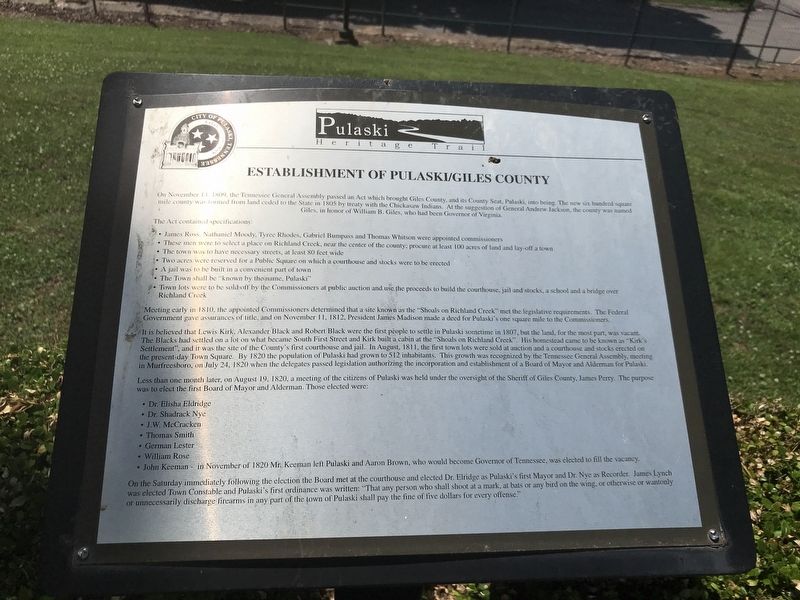
On November 14. 1809, the Tennessee General Assembly passed an Act which brought Giles County, and its County Seat, Pulaski, into being. The new six hundred square mile county was formed from land ceded to the State in 1805 by treaty with the Chickasaw Indians. At the suggestion of General Andrew Jackson, the county was named Giles, in honor of William B. Giles, who had been Governor of Virginia.
The Act contained specifications:
James Ross, Nathaniel Moody, Tyree Rhodes, Gabriel Bumpass and Thomas Whitson were appointed commissioners
These men were to select a place on Richland Creek, near the center of the county; procure at least 100 acres of land and lay-off a town
The town was to have necessary streets, at least 80 feet wide
Two acres were reserved for a Public Square on which a courthouse and stocks were to be erected
A jail was to be built in a convenient part of town
The Town shall be “known by the name, Pulaski"
Town lots were to be sold off by the Commissioners at public auction and use the proceeds to build the courthouse, jail and stocks, a school and a bridge over Richland Creek
Meeting early in 1810, the appointed Commissioners determined that a site known as the “Shoals on Richland Creek” met the legislative requirements. The Federal Government gave assurances of title, and on November 11, 1812, President James Madison made a deed for Pulaski's one square mile to the Commissioners.
It is believed that Lewis Kirk, Alexander Black and Robert Black were the first people to settle in Pulaski sometime in 1807, but the land, for the most part, was vacant. The Blacks had settled on a lot on what became South First Street and Kirk built a cabin at the “Shoals on Richland Creek”. His homestead came to be known as “Kirk's Settlement”, and it was the site of the County's first courthouse and jail. In August, 1811, the first town lots were sold at auction and a courthouse and stocks erected on the present-day Town Square. By 1820 the population of Pulaski had grown to 512 inhabitants. This growth was recognized by the Tennessee General Assembly, meeting in Murfreesboro, on July 24, 1820 when the delegates passed legislation authorizing the incorporation and establishment of a Board of Mayor and Alderman for Pulaski.
Less than one month later, on August 19, 1820, a meeting of the citizens of Pulaski was held under the oversight of the Sheriff of Giles County, James Perry. The purpose was to elect the first Board of Mayor and Alderman. Those elected were:
Dr. Elisha Eldridge
Dr. Shadrack Nye
J.W. McCracken
Thomas Smith
German Lester
William
Rose
John Keeman - in November of 1820 Mr. Keeman left Pulaski and Aaron Brown, who would become Governor of Tennessee, was elected to fill the vacancy.
On the Saturday immediately following the election the Board met at the courthouse and elected Dr. Elridge as Pulaski's first Mayor and Dr. Nye as Recorder. James Lynch was elected Town Constable and Pulaski's first ordinance was written: “That any person who shall shoot at a mark, at bats or any bird on the wing, or otherwise or wantonly or unnecessarily discharge firearms in any part of the town of Pulaski shall pay the fine of five dollars for every offense.”
Erected by City of Pulaski.
Topics and series. This historical marker is listed in this topic list: Settlements & Settlers. In addition, it is included in the Former U.S. Presidents: #04 James Madison series list. A significant historical date for this entry is November 14, 1809.
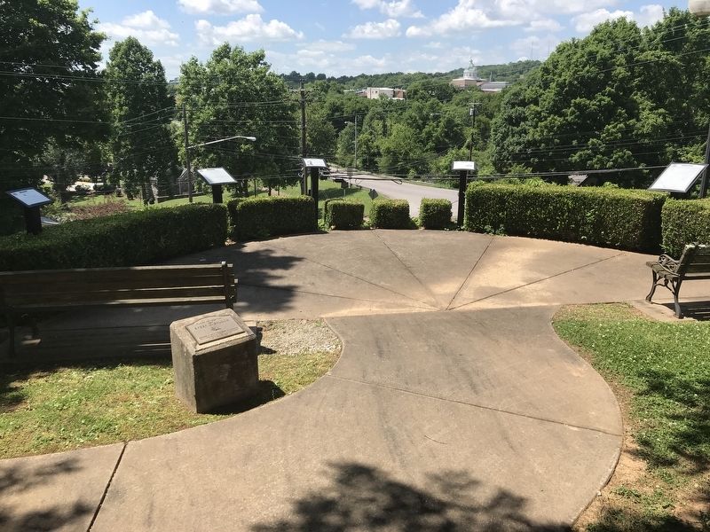
Location. 35° 11.705′ N, 87° 1.733′ W. Marker is in Pulaski, Tennessee, in Giles County. Marker can be reached from South Sam Douglas Avenue south of East College Street. The marker is located on an overlook behind the recreation center. Touch for map. Marker is at or near this postal address: 333 E College St, Pulaski TN 38478, United States of America. Touch for directions.
Other nearby markers. At least 8 other markers are within walking distance of this marker. Native Americans in Giles County (here, next to this marker); Count Casimir Pulaski (1747-1779)
(here, next to this marker); Giles County Courthouses (here, next to this marker); Pulaski Academy (within shouting distance of this marker); Trail of Tears (within shouting distance of this marker); Nunahi-Duna-Dlo-Hily-I (within shouting distance of this marker); The Benge Route (about 400 feet away, measured in a direct line); John Adams (about 400 feet away). Touch for a list and map of all markers in Pulaski.
Regarding Establishment of Pulaski / Giles County. Presumably, the Elridge in the last paragraph of the inscription is the same person as the Elbridge listed earlier. The spelling inconsistency has been transcribed verbatim from the marker.
Credits. This page was last revised on March 15, 2021. It was originally submitted on June 9, 2020, by Duane and Tracy Marsteller of Murfreesboro, Tennessee. This page has been viewed 354 times since then and 42 times this year. Last updated on March 15, 2021, by Carl Gordon Moore Jr. of North East, Maryland. Photos: 1, 2. submitted on June 9, 2020, by Duane and Tracy Marsteller of Murfreesboro, Tennessee. 3. submitted on June 14, 2020, by Duane and Tracy Marsteller of Murfreesboro, Tennessee. • Bill Pfingsten was the editor who published this page.


