Near St. Charles in St. Charles County, Missouri — The American Midwest (Upper Plains)
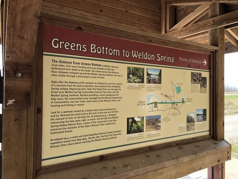
Greens Bottom to Weldon Spring
Points of Interest
The distance from Greens Bottom to Weldon Spring is 10.30 miles. Trail users heading west pass between bluffs and bottomland farm fields in this wide, flat inside bend of the Missouri River. Between milepost 49 and the Weldon Spring trailhead, the river is often visible through a picturesque screen of trees.
Right after the Highway 40/61 overpass at milepost 51.3 are the remains of a structure from the quarry operation once located at the old Weldon Spring railstop. Beginning here, Katy Trail State Park runs through the 8,000-acre Weldon Spring Conservation Area for five miles until the Weldon Spring trailhead. Besides providing a scenic background for Katy users, the conservation area, managed by the Missouri Department of Conservation, has four trails, boat access to the Missouri River, and hunting and fishing in season.
Look for a wetland created by a beaver dam around mileposts 52 and 53. Railroad ties piled next to the trail in this area are left from the removal of rails on the Katy line. At milepost 53.5, a footpath intersecting the Katy leads right, or north, into the 385-acre Weldon Spring Hollow Natural Area, a piece of the conservation area that preserves the character of the state's Missouri River upland and bottomland forests.
At milepost 54.4 a Lewis and Clark Expedition historical marker describes expedition events from May 1804. Shortly after, the Katy Trail leaves the Missouri River shore before reaching the Weldon Spring trailhead.
Erected by Missouri State Parks.
Topics and series. This historical marker is listed in these topic lists: Exploration • Railroads & Streetcars. In addition, it is included in the Katy Trail State Park series list. A significant historical month for this entry is May 1804.
Location. 38° 42.938′ N, 90° 34.023′ W. Marker is near St. Charles, Missouri, in St. Charles County. Marker can be reached from Greens Bottom Road, 1.3 miles west of Jungs Station Road, on the right when traveling west. Touch for map. Marker is at or near this postal address: 3509 Katy Trail, Saint Charles MO 63303, United States of America. Touch for directions.
Other nearby markers. At least 8 other markers are within 4 miles of this marker, measured as the crow flies. Greens Bottom to St. Charles (here, next to this marker); Centennial Greenway - Heritage Crossing (approx. 2.7 miles away); Centennial Greenway - Katy Trail State Park (approx. 2.9 miles away); Icehouse (approx. 3.4 miles away); Smoke House (approx. 3˝ miles away); Thornhill (approx. 3˝ miles away); P.O.W. - M.I.A. Memorial (approx. 3˝ miles away); Hoch House (approx. 3.7 miles away). Touch for a list and map of all markers in St. Charles.
Credits. This page was last revised on February 14, 2023. It was originally submitted on March 27, 2021, by Devry Becker Jones of Washington, District of Columbia. This page has been viewed 163 times since then and 23 times this year. Photos: 1, 2. submitted on March 27, 2021, by Devry Becker Jones of Washington, District of Columbia.

