Grand Forks in Grand Forks County, North Dakota — The American Midwest (Upper Plains)
Lincoln Drive - a neighborhood history
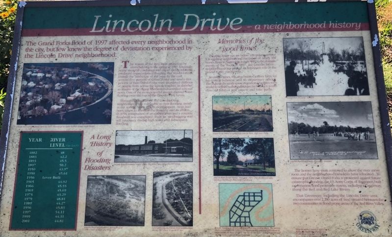
The Grand Forks flood of 1997 affected every neighborhood in the city but few knew the degree of devastation experienced by the Lincoln Drive neighborhood.
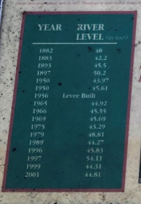
The waters of the Red River proved to be overwhelming in the spring 1997. Unusually heavy snowfall combined with rapid spring warming produced unprecedented flooding that would forever change the land scape of the area. In the end seventy-five percent of Grand Forks and ninety-five percent of East Grand Forks were inundated. Millions of people from across the nation watched in disbelief as images of the raging floodwaters dominated national news. One of the most powerful images showed water flowing over the top of the Lincoln Park Levee.
Throughout its history the Lincoln Drive neighborhood was vulnerable to river flooding, mostly in the spring. Since its first development, steps had been taken to alleviate the flooding and its effects. In 1956 construction of an earthen levee and a concrete floodwall was completed. Even so, sandbagging was still necessary during high water and subsequent flooding.
Memories of the good times
The open space you see before you today was once a flourishing neighborhood comprised of nearly 350 homes. From its beginnings in early 1882 to the dramatic event of the flood of 1997 the Lincoln Drive neighborhood has played an important role in the Grand Forks community.
At various times, this area boasted a dairy farm, ice harvesting business, and an elementary school. Throughout the years many recreational facilities ere available within walking distance including a world class ski jump, a golf course and bike path.
The homes here were removed to allow the river more room and the neighborhood's residents have relocated. To ensure that Greater Grand Forks is protedtct3ed against future catastrophic flooding, the US Army Corps of Engineers built a permanent flood protection system, including a Greenway along the Red and Red Lake Rivers.
That Greenway, including the Lincoln Drive area encompasses over 2,200 acres of land situated between the two communities in flood prone areas of the Red River Valley.
Picture Captions
Lincoln Drive neighborhood, April 18, 1997, Photograph by Jackie Lin.. Grand Forks Herald.
Lincoln Park Elementary School 1949. This school was lost in the 1997 flood.
Lincoln Drive neighborhood during flood of 1950.
Levee picture the Lincoln Drive neighborhood during 1965 flood. Crest 44.92 feet.
Grand Forks trolley at entrance of Lincoln Park. Post card 1912.
Lincoln Park Shelter House. Post Card. 1911. This facility was also known at the Lincoln Park Golf Club House.
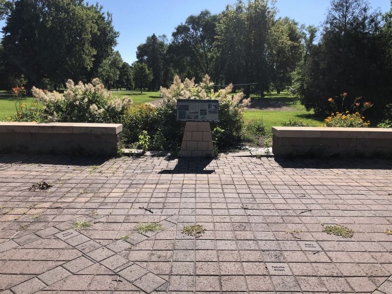
You are standing at the Lincoln Drive Park interpretive plaza.
Lincoln Park Ski Jump, Circa 1918.
Lincoln Park Golf Course. Post Card undated.
Erected by Grand Forks Greenway.
Topics. This historical marker is listed in this topic list: Disasters. A significant historical date for this entry is April 19, 1997.
Location. 47° 54.639′ N, 97° 1.353′ W. Marker is in Grand Forks, North Dakota, in Grand Forks County. Marker is on Euclid Avenue. The marker is located in Lincoln Park. Touch for map. Marker is at or near this postal address: 120 Euclid Avenue, Grand Forks ND 58201, United States of America. Touch for directions.
Other nearby markers. At least 8 other markers are within walking distance of this marker. Votes For Women (approx. 0.9 miles away); Alexander Griggs (approx. 0.9 miles away); Grand Forks County Courthouse (approx. 0.9 miles away); Lustron (approx. one mile away); Blooming 46 School House (approx. one mile away); North Dakota's Oldest Concrete Pavement (approx. one mile away); Grand Forks' First Post Office (approx. one mile away); Electric Construction Company (approx. one mile away). Touch for a list and map of all markers in Grand Forks.
Credits. This page was last revised on April 1, 2021. It was originally submitted on March 30, 2021, by Ruth VanSteenwyk of Aberdeen, South Dakota. This page has been viewed 334 times since then and 40 times this year. Photos: 1, 2, 3. submitted on March 30, 2021, by Ruth VanSteenwyk of Aberdeen, South Dakota. • Bill Pfingsten was the editor who published this page.


