Near Bell Isle Gardens in Georgetown County, South Carolina — The American South (South Atlantic)
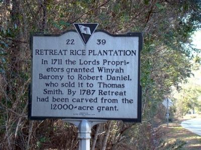
Retreat Rice Plantation
Erected 1994 by Whites Bridge Garden Club. (Marker Number 22-39.)
Topics. This historical marker is listed in this topic list: Political Subdivisions. A significant historical year for this entry is 1711.
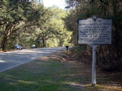
Location. 33° 16.267′ N, 79° 17.85′ W. Marker is near Bell Isle Gardens, South Carolina, in Georgetown County. Marker is at the intersection of South Island Drive (Local Highway S-22-18) and Wright Skinner Drive, on the right when traveling south on South Island Drive. Touch for map. Marker is in this post office area: Georgetown SC 29440, United States of America. Touch for directions.
Other nearby markers. At least 8 other markers are within 7 miles of this marker, measured as the crow flies. Lest We Forget (approx. 2.3 miles away); 1st Battalion 178th Field Artillery (approx. 3.8 miles away); The Oaks Plantation (approx. 6.1 miles away); Hopsewee (approx. 6.4 miles away); John and Mary Perry Cleland House (approx. 6˝ miles away); Rice is King (approx. 6˝ miles away); South Carolina’s Third Oldest City (approx. 6.6 miles away); Sinking Of The USS Harvest Moon (approx. 6.6 miles away).
Regarding Retreat Rice Plantation. From Wikipedia: “The Province of Carolina from 1663 to 1712, was a North American British proprietary colony, controlled by the Lords Proprietary, a group of eight English noblemen led informally by member Anthony Ashley-Cooper, 1st Earl of Shaftesbury. ... The division between North and South became complete in 1712, but both colonies remained in the hands of the same group of proprietors.”
Credits. This page was last revised on June 16, 2016. It was originally submitted on March 14, 2009, by J. J. Prats of Powell, Ohio. This page has been viewed 1,541 times since then and 60 times this year. Photos: 1, 2. submitted on March 14, 2009, by J. J. Prats of Powell, Ohio.

