Ida in Monroe County, Michigan — The American Midwest (Great Lakes)
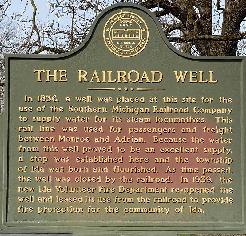
The Railroad Well
Erected by Monroe County Historical Commission.
Topics. This historical marker is listed in this topic list: Railroads & Streetcars. A significant historical year for this entry is 1836.
Location. 41° 54.502′ N, 83° 34.442′ W. Marker is in Ida, Michigan, in Monroe County. Marker is on Lewis Avenue, 0.1 miles north of Ida Street, on the left when traveling north. Touch for map. Marker is at or near this postal address: 3016 Lewis Ave, Ida MI 48140, United States of America. Touch for directions.
Other nearby markers. At least 8 other markers are within 5 miles of this marker, measured as the crow flies. Ida Village / Ida Township (about 400 feet away, measured in a direct line); Bridge School (approx. 3.9 miles away); a different marker also named Bridge School (approx. 3.9 miles away); Meyer Rosen Foundation Holiday Camp (approx. 4.2 miles away); Peter Seitz Tavern & Stagecoach Inn (approx. 4.3 miles away); West County Park (approx. 4.8 miles away); First People of Monroe County (approx. 4.8 miles away); The River Raisin (approx. 4.8 miles away). Touch for a list and map of all markers in Ida.
Credits. This page was last revised on April 6, 2021. It was originally submitted on April 6, 2021, by J.T. Lambrou of New Boston, Michigan. This page has been viewed 206 times since then and 28 times this year. Photos: 1, 2. submitted on April 6, 2021, by J.T. Lambrou of New Boston, Michigan. • Mark Hilton was the editor who published this page.

