Pontotoc in Pontotoc County, Mississippi — The American South (East South Central)
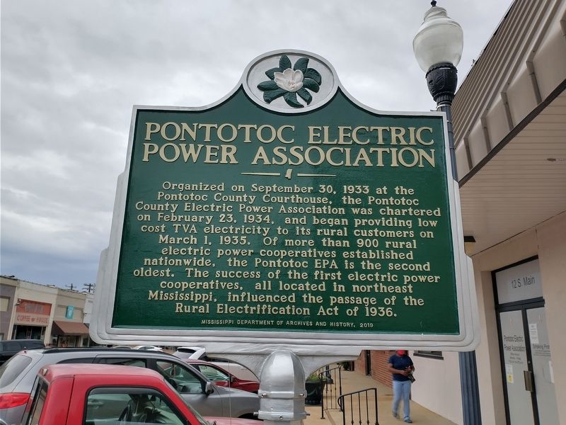
Pontotoc Electric Power Association
Erected 2019 by Mississippi Department of Archives and History.
Topics and series. This historical marker is listed in this topic list: Industry & Commerce. In addition, it is included in the Rural Electrification 💡 series list. A significant historical date for this entry is February 23, 1934.
Location. 34° 14.915′ N, 88° 59.943′ W. Marker is in Pontotoc, Mississippi, in Pontotoc County. Marker is at the intersection of South Main Street and East Jefferson Street, on the right when traveling north on South Main Street. Touch for map. Marker is at or near this postal address: 12 S Main St, Pontotoc MS 38863, United States of America. Touch for directions.
Other nearby markers. At least 8 other markers are within walking distance of this marker. Pontotoc Creek Treaty (about 300 feet away, measured in a direct line); Pontotoc County Blues (about 400 feet away); Pontotoc County Confederate Monument (about 400 feet away); Pontotoc County Memorial Monument (about 400 feet away); Pierre D'Artaguiette (about 500 feet away); Jim Weatherly (approx. 0.3 miles away); Pontotoc Cemetery (approx. 0.4 miles away); Senator Charles Edward Franklin, Sr. (approx. 0.4 miles away). Touch for a list and map of all markers in Pontotoc.
Also see . . . PEPA Timeline. (Submitted on April 24, 2021, by Tom Bosse of Jefferson City, Tennessee.)
Credits. This page was last revised on April 25, 2021. It was originally submitted on April 24, 2021, by Tom Bosse of Jefferson City, Tennessee. This page has been viewed 167 times since then and 29 times this year. Photos: 1, 2. submitted on April 24, 2021, by Tom Bosse of Jefferson City, Tennessee. • Bernard Fisher was the editor who published this page.

