Pigeon Forge in Sevier County, Tennessee — The American South (East South Central)
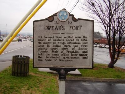
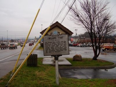
Wear's Fort
Erected by Tennessee Historical commission. (Marker Number 1C 16.)
Topics and series. This historical marker is listed in these topic lists: Forts and Castles • War, US Revolutionary. In addition, it is included in the Tennessee Historical Commission series list. A significant historical year for this entry is 1783.
Location. 35° 48.405′ N, 83° 34.655′ W. Marker is in Pigeon Forge, Tennessee, in Sevier County. Marker is on The Great Somky Mountains Highway (Route 441). Touch for map. Marker is in this post office area: Pigeon Forge TN 37863, United States of America. Touch for directions.
Other nearby markers. At least 8 other markers are within 2 miles of this marker, measured as the crow flies. Fort Wear (approx. 0.3 miles away); Shiloh Church (approx. half a mile away); a different marker also named Shiloh Church (approx. half a mile away); Henderson Springs Resort (approx. 0.7 miles away); Pine Grove Rural Community (approx. 0.8 miles away); Titanic Eternal Flame (approx. one mile away); Titanic’s Center Anchor (approx. one mile away); Early Pigeon Forge (approx. 1.8 miles away). Touch for a list and map of all markers in Pigeon Forge.
Credits. This page was last revised on June 16, 2016. It was originally submitted on March 19, 2009, by Stanley and Terrie Howard of Greer, South Carolina. This page has been viewed 1,658 times since then and 36 times this year. Photos: 1, 2. submitted on March 19, 2009, by Stanley and Terrie Howard of Greer, South Carolina. • Craig Swain was the editor who published this page.

