Des Arc in Prairie County, Arkansas — The American South (West South Central)
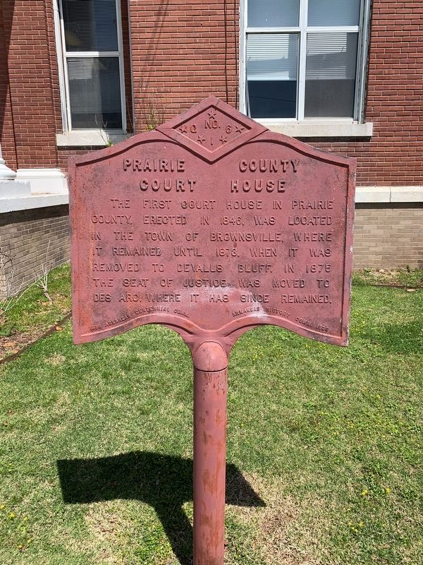
Prairie County Court House
Erected 1936 by 1836 Arkansas Centennial Commission; Arkansas History Commission. (Marker Number G 16.)
Topics and series. This historical marker is listed in these topic lists: Government & Politics • Political Subdivisions. In addition, it is included in the Arkansas Centennial Commission series list. A significant historical year for this entry is 1846.
Location. 34° 58.651′ N, 91° 29.663′ W. Marker is in Des Arc, Arkansas, in Prairie County. Marker is on West Courthouse Square just west of North 2nd Street, on the right when traveling west. Touch for map. Marker is at or near this postal address: 200 Courthouse Square, Des Arc AR 72040, United States of America. Touch for directions.
Other nearby markers. At least 8 other markers are within 14 miles of this marker, measured as the crow flies. Des Arc (about 700 feet away, measured in a direct line); First Presbyterian Church Des Arc, Arkansas (approx. 0.2 miles away); DeValls Bluff: A Major Union Riverport (approx. 13.3 miles away); The Memphis and Little Rock Railroad (approx. 13.4 miles away); a different marker also named Memphis and Little Rock Railroad (approx. 13.4 miles away); Why DeValls Bluff (approx. 13˝ miles away); War on the White River (approx. 13˝ miles away); DeValls Bluff: A Key Union Base (approx. 13˝ miles away). Touch for a list and map of all markers in Des Arc.
Credits. This page was last revised on May 2, 2021. It was originally submitted on April 28, 2021, by Thomas Smith of Waterloo, Ill. This page has been viewed 104 times since then and 16 times this year. Photos: 1, 2, 3. submitted on April 28, 2021, by Thomas Smith of Waterloo, Ill. • Devry Becker Jones was the editor who published this page.


