Opelousas in St. Landry Parish, Louisiana — The American South (West South Central)
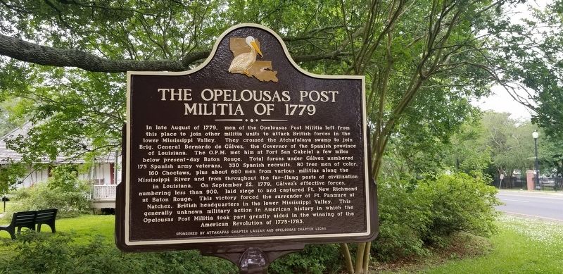
The Opelousas Post Militia of 1779
In late August of 1779, men of the Opelousas Post Militia left from this place to join other militia units to attack British forces in the lower Mississippi Valley. They crossed the Atchafalaya swamp to join Brig. General Bernardo de Gálvez, the Governor of the Spanish province of Louisiana. The O.P.M. met him at Fort San Gabriel a few miles below present-day Baton Rouge. Total forces under Gálvez numbered 175 Spanish army veterans, 330 Spanish recruits, 80 free men of color, 160 Choctaws, plus about 600 men from various militias along the Mississippi River and from throughout the far-flung posts of civilization in Louisiana. On September 22, 1779, Gálvez's effective forces, numbering less than 900, laid siege to and captured Ft. New Richmond at Baton Rouge. This victory forced the surrender of Ft. Panmure at Natchez, British headquarters in the lower Mississippi Valley. This generally unknown military action in American history in which the Opelousas Post Militia took part greatly aided in the winning of the American Revolution of 1775-1783.
Erected by Attakapas Chapter LASSAR and Opelousas Chapter LSDAR.
Topics and series. This historical marker is listed in this topic list: War, US Revolutionary. In addition, it is included in the Daughters of the American Revolution, and the Sons of the American Revolution (SAR) series lists. A significant historical date for this entry is September 22, 1779.
Location. 30° 31.906′ N, 92° 4.432′ W. Marker is in Opelousas, Louisiana, in St. Landry Parish. Marker is at the intersection of Ronald Reagan Highway / East Landry Highway (U.S. 190) and Wallior Street, on the left when traveling west on Ronald Reagan Highway / East Landry Highway. Touch for map. Marker is at or near this postal address: 828 East Landry Highway, Opelousas LA 70570, United States of America. Touch for directions.
Other nearby markers. At least 8 other markers are within walking distance of this marker. Preston "Sweet" Fontenot (a few steps from this marker); Rosa B. Scott (Anderson) (a few steps from this marker); J.S. Clark High School (within shouting distance of this marker); Doctor's Office (within shouting distance of this marker); Le Vieux Village (within shouting distance of this marker); Opelousas Firsts and Famous/ Hall of Fame (within shouting distance of this marker); Venus House (within shouting distance of this marker); Acadian House / Pigeoneer (within shouting distance of this marker). Touch for a list and map of all markers in Opelousas.
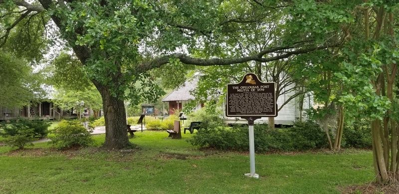
More about this marker. Located on the grounds of Le Vieux Village Historical Park & Heritage Museum at the western entrance of Opelousas along U.S. Highway 190.
Credits. This page was last revised on May 15, 2021. It was originally submitted on April 30, 2021, by Cajun Scrambler of Assumption, Louisiana. This page has been viewed 776 times since then and 214 times this year. Photos: 1, 2. submitted on May 1, 2021, by Cajun Scrambler of Assumption, Louisiana.

