Kingsbridge in the Bronx in Bronx County, New York — The American Northeast (Mid-Atlantic)
Original King's Bridge
Photographed by Andrew Ruppenstein, May 2, 2021
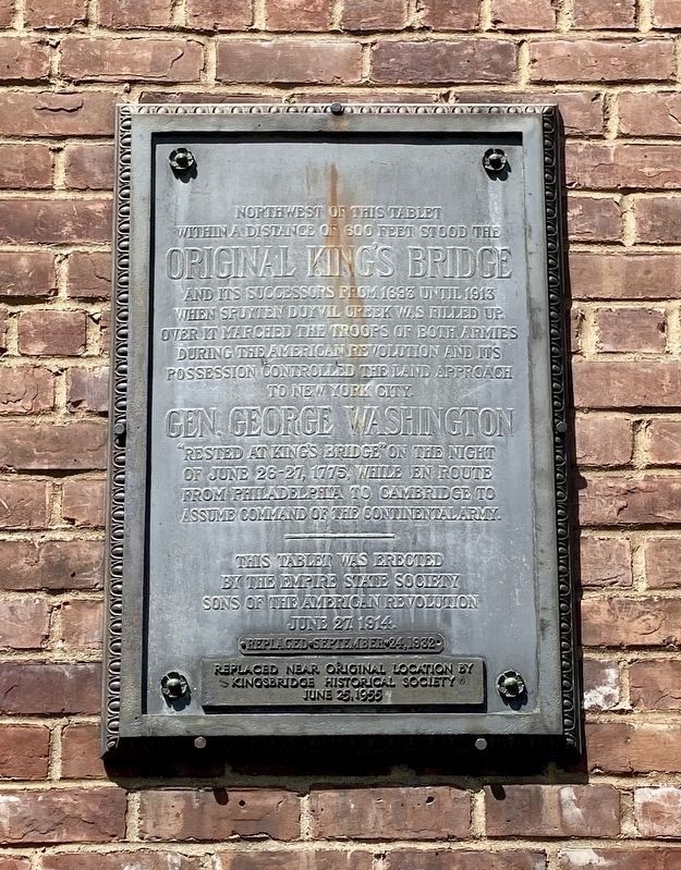
1. Original King's Bridge Marker
Northwest of this tablet
within a distance of 600 feet stood the
Original King's Bridge
and its successors from 1693 until 1913
when Spuyten Duyvil creek was filled up.
Over it marched the troops of both armies
during the American Revolution and its
possession controlled the land approach
to New York City.
Gen. George Washington
"rested at King's Bridge" on the night
of June 26-27, 1775, while en route
from Philadelphia to Cambridge to
assume command of the Continental Army.
This tablet was erected
by the Empire State Society
Sons of the American Revolution
June 27, 1914
Replaced September 24, 1932
Replaced near original location by
Kingsbridge Historical Society
June 25,1955
Erected 1914 by Sons of the American Revolution, Empire State Society.
Topics and series. This historical marker is listed in these topic lists: Bridges & Viaducts • War, US Revolutionary. In addition, it is included in the George Washington Slept Here, and the Sons of the American Revolution (SAR) series lists. A significant historical date for this entry is June 26, 1775.
Location. 40° 52.604′ N, 73° 54.442′ W. Marker is in
this page online

Regionally, this marker is in New York City. It is also in the American Northeast, in the Mid-Atlantic, and on the Eastern Seaboard. Globally, it is in the North Atlantic Region, North America, the Western Hemisphere, the Western World, and the Anglosphere. Historically, it finds itself in what was once New Netherland and also one of the original Thirteen Colonies.
Other nearby markers. At least 8 other markers are within walking distance of this marker: Marble Hill Playground (about 400 feet away, measured in a direct line); The Wading Place / Kings Bridge / Fort Prince Charles (about 400 feet away); Carolina Baptist Church (about 700 feet away); Fort Number Four (approx. half a mile away); Fort Independence Park (approx. 0.7 miles away); Henry Hudson Park (approx. 0.7 miles away); Henry Hudson Monument (approx. 0.7
Photographed by Andrew Ruppenstein, May 2, 2021
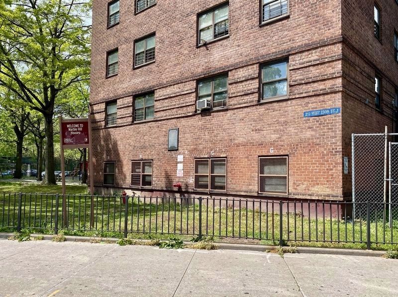
2. Original King's Bridge Marker - wide view
The marker is visible here about 7 feet off the ground, between the two windows mid-building.
More about this marker. Although the marker has a West 230th Street address, the marker is mounted to a building with the marker side of the building facing Broadway.
courtesy of the Kingsbridge Historical Society, circa 1906
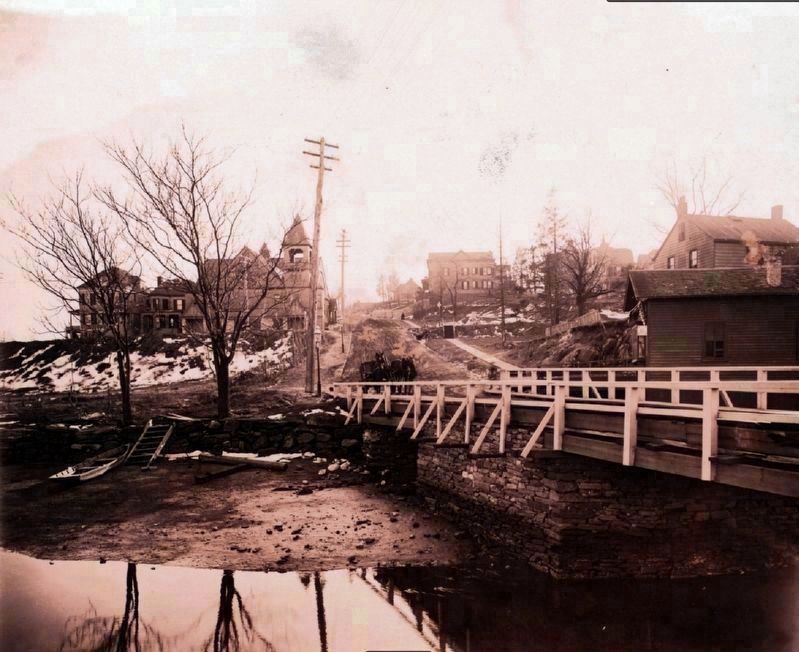
3. King's Bridge over Spuyten Duyvil Creek
Note that the creek was filled in by 1913, thus joining (a remnant of) Manhattan to the Bronx. Note the building in the background with the tower (just to the left of the road) is St. Stephens United Methodist Church, which is still extant and currently also bears a historical marker commemorating the King's Bridge.
Hidden Waters blog entry
Click for more information.
Hidden Waters blog entry
Click for more information.
Credits. This page was last revised on September 10, 2025. It was originally submitted on May 7, 2021, by Andrew Ruppenstein of Lamorinda, California. This page has been viewed 6,459 times since then and 854 times this year. Photos: 1, 2, 3. submitted on May 7, 2021, by Andrew Ruppenstein of Lamorinda, California.
