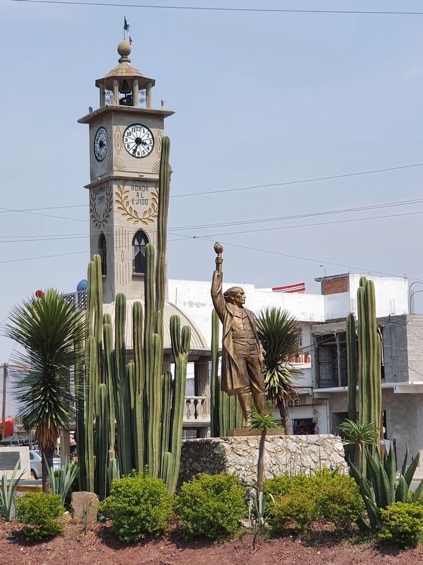
Tlahuelilpan, Hidalgo, Mexico — The Central Highlands (North America)
Foundation of the Municipality of Tlahuelilpan
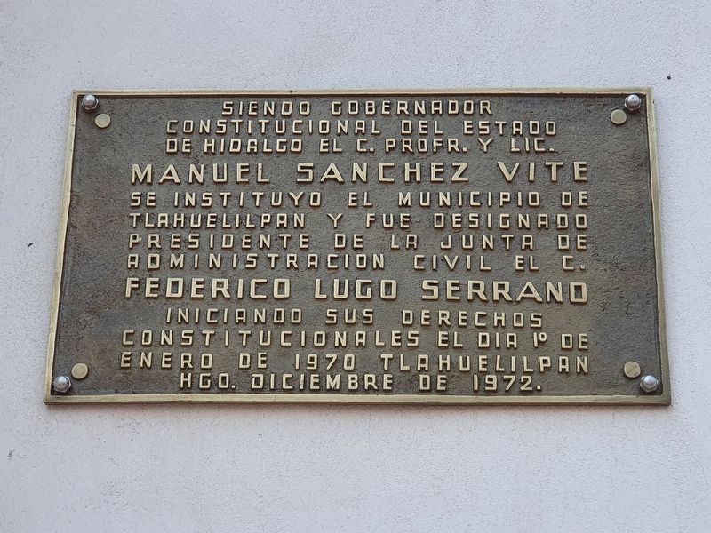
Inscription.
Se instituyo el Municipio de Tlahuelilpan y fue designado Presidente de la Junta de Administracion Civil el C. Federico Lugo Serrano iniciando sus derechos constitucionales el dia 1º de enero de 1970
Tlahuelilpan Hgo. Diciembre de 1972.
During the term of the Constitutional Governor of the State of Hidalgo, Professor Manuel Sánchez Vite,
The Municipality of Tlahuelilpan was established and Federico Lugo Serrano was appointed Chairman of the Civil Administration Board, initiating its constitutional rights on January 1, 1970
Tlahuelilpan, Hidalgo, December 1972.
Erected 1972.
Topics. This historical marker is listed in this topic list: Political Subdivisions. A significant historical date for this entry is January 1, 1970.
Location. 20° 7.892′ N, 99° 14.041′ W. Marker is in Tlahuelilpan, Hidalgo. Marker is on Route 30 just east of Paseo del Agrarismo, on the left when traveling east. Touch for map. Marker is in this post office area: Tlahuelilpan HGO 42780, Mexico. Touch for directions.
Other nearby markers. At least 8 other markers are within 14 kilometers of this marker, measured as the crow flies. First International Book and Reading Fair (approx. 7.9 kilometers away); First House in Mixquiahuala (approx. 11.1 kilometers away); Mixquiahuala Tribute to Benito Juárez (approx. 11.1 kilometers away); Mixquiahuala as the Site of State Congress (approx. 11.1 kilometers away); Tula (approx. 13.3 kilometers away); Ball Court 1 (approx. 13.3 kilometers away); El Coatepantli (Wall of Snakes) (approx. 13.4 kilometers away); The Temple of Pyramid B (approx. 13.4 kilometers away).
Credits. This page was last revised on May 7, 2021. It was originally submitted on May 7, 2021, by J. Makali Bruton of Accra, Ghana. This page has been viewed 89 times since then and 12 times this year. Photos: 1, 2, 3, 4, 5. submitted on May 7, 2021, by J. Makali Bruton of Accra, Ghana.
