Gold Hill in Storey County, Nevada — The American Mountains (Southwest)
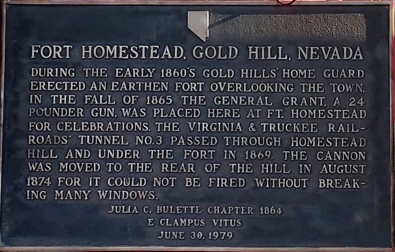
Fort Homestead, Gold Hill, Nevada
Erected 1979 by E Clampus Vitus.
Topics and series. This historical marker is listed in this topic list: Forts and Castles. In addition, it is included in the E Clampus Vitus series list.
Location. 39° 17.596′ N, 119° 39.329′ W. Marker is in Gold Hill, Nevada, in Storey County. Marker is on Homestead Road. Touch for map. Marker is at or near this postal address: 1460 Homestead Road, Virginia City NV 89440, United States of America. Touch for directions.
Other nearby markers. At least 8 other markers are within walking distance of this marker. Liberty Engine Company No. 1 (about 300 feet away, measured in a direct line); Maynard Block (about 400 feet away); Liberty Engine Co. No.1 (about 500 feet away); Assay Office and Justice Court (about 500 feet away); Silver Star Lodge # 5 (about 600 feet away); Gold Hill Millionaires (about 600 feet away); Gold Hill Hotel (about 600 feet away); The Yellow Jacket Mine Fire (about 700 feet away). Touch for a list and map of all markers in Gold Hill.
Credits. This page was last revised on May 28, 2021. It was originally submitted on May 10, 2021, by Matthew J Ebert of Gerlach, NV. This page has been viewed 325 times since then and 52 times this year. Photo 1. submitted on May 28, 2021, by Matthew J Ebert of Gerlach, NV. • Bill Pfingsten was the editor who published this page.
Editor’s want-list for this marker. Wide area view of the marker and its surroundings. • Can you help?
