Near Lacey Spring in Rockingham County, Virginia — The American South (Mid-Atlantic)
Melrose Caverns
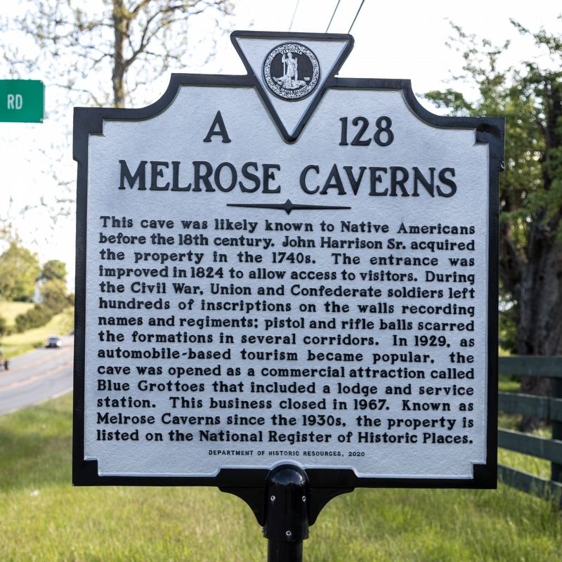
This cave was likely known to Native Americans before the l8th century. John Harrison Sr. acquired the property in the 1740s. The entrance was improved in 1824 to allow access to visitors. During the Civil War, Union and Confederate soldiers left hundreds of inscriptions on the walls recording names and regiments; pistol and rifle balls scarred the formations in several corridors. In 1929, as automobile-based tourism became popular, the cave was opened as a commercial attraction called Blue Grottoes that included a lodge and service station. This business closed in 1967. Known as Melrose Caverns since the 1930s, the property is listed on the National Register of Historic Places.
Erected 2020 by Department of Historic Resources. (Marker Number A-128.)
Topics and series. This historical marker is listed in this topic list: Notable Places. In addition, it is included in the Virginia Department of Historic Resources (DHR) series list. A significant historical year for this entry is 1824.
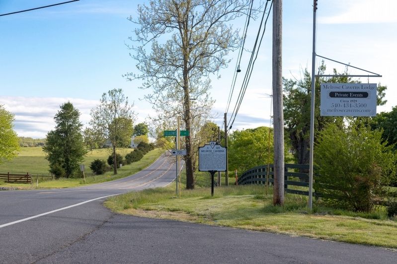
Location. 38° 30.993′ N, 78° 47.56′ W. Marker is near Lacey Spring, Virginia, in Rockingham County. Marker is at the intersection of North Valley Pike (U.S. 11) and Fellowship Road, on the right when traveling south on North Valley Pike. Touch for map . Marker is at or near this postal address: 6637 North Valley Pk, Harrisonburg VA 22802, United States of America. Touch for directions.
Other nearby markers. At least 8 other markers are within 4 miles of this marker, measured as the crow flies. Long's Chapel and Zenda (approx. 1.6 miles away); Cavalry Engagement (approx. 1.9 miles away); Lacey Spring (approx. 2.1 miles away); Abraham Lincoln’s Father (approx. 2.3 miles away); Baxter House (approx. 3.6 miles away); Mannheim (approx. 3.7 miles away); Edom United Methodist Church (approx. 3.7 miles away); Lincoln's Virginia Ancestors (approx. 3.7 miles away).
Also see . . .
1. Melrose Civil War Caverns. Website homepage:
Includes a gallery of photographs. Excerpt:
Melrose Caverns offered a secure place to store rifles, ammunition and supplies. 40 feet below ground, the caverns were invisible to their adversaries, and provided a consistent temperature of 55°F.(Submitted on May 12, 2021.)
Troops carved stairs into the cavern walls which allowed them to store and retrieve their supplies as well as provide access for as many as 150 troops that occupied the caverns.
2. National Register of Historic Places Nomination Form (PDF). Excerpts:
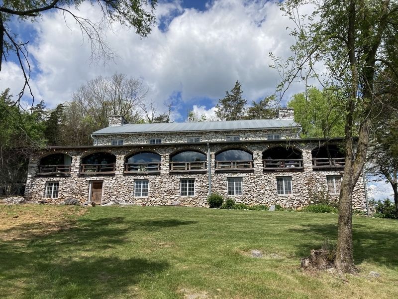
Melrose Lodge, 1929, Contributing Building(Submitted on May 13, 2021.)
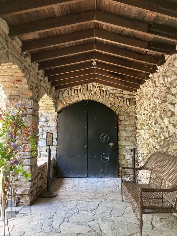
The lodge, constructed in a Rustic architectural style between 1928 and 1929, opened for business on June 19, 1929, and remains much today as it did then. The large, rectangular-shaped, two-bay, two-story, gable-fronted, limestone-clad building stands on a raised limestone-clad basement and is accented by two large exterior-end (engaged) limestone chimneys. Its gable-fronted façade is dominated by the centered chimney, which is flanked by double-leaf, glass-paned doors, with an elaborate three-bay, wraparound front porch with double stone staircases lined with hand-wrought metal hand railings. The wraparound porch towers over the building with its series of elliptically arched openings with round log balustrade. The use of the uncoursed fieldstone, and the wood treatments, produces a dramatic surface treatment, reminiscent of the National Park Service lodges of the 1920s and 1930s.
The lodge was built into the hillside (of the cave) with its façade facing east and its longitudinal, south elevation exposed and visible from the driveway. Two wings, housing an office and a reading room, extend off each corner of the north elevation. The lodge is located about 225 feet down the access road from the historically associated Filling Station (see below) and U.S. Route 11. The gravel and grass driveway loops around in front of the lodge. The arched porch openings on the side and rear elevation have been in filled with framed knee walls and plywood and sliding wood windows. A ca. 1980s one-story bathroom section was addedto the rear elevation but is obscured from view, although it does block the rear porch. The medium-pitched, front-gabled roof is covered with corrugated metal. A series of five bays on both floors of the southeast longitudinal elevation light the interior space. …
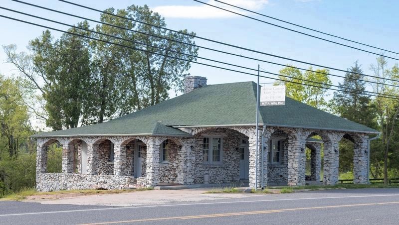
Melrose Filling Station, 1929, Contributing Building
The one-story, three-bay filling station was constructed in the same rustic architecture as the lodge with un-coursed limestone fieldstone walls, stone arched porches wrapping around three sides (also in-filled with plywood), its triple-arched stone canopy for the gas pumps, and a large interior stone chimney. Asphalt shingles and corrugated metal covers its hipped roof and original, paired six-over-six wood windows light the interior. The building also served as an information station, another possible tourist enticement. The building stands in the fork of the access road that converges as it leads straight to the lodge and caverns from U.S. Route 11, 500 feet northeast of the Harrison House. More recently used as a single dwelling, the interior is open across the width of the station with a centered fieldstone fireplace accenting the main wall. A bathroom is off of this room, as well as two entrances to the side porches that have been in-filled for the rental unit. This building is vacant, in good condition, and ready for a new use to serve the community once again along U.S. Route 11.
Credits. This page was last revised on April 30, 2024. It was originally submitted on May 12, 2021, by J. J. Prats of Powell, Ohio. This page has been viewed 583 times since then and 64 times this year. Photos: 1, 2, 3. submitted on May 12, 2021, by J. J. Prats of Powell, Ohio. 4, 5, 6. submitted on April 29, 2024, by Linda Walcroft of Woodstock, Virginia.
