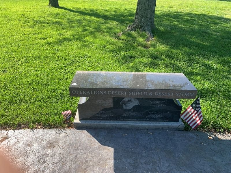
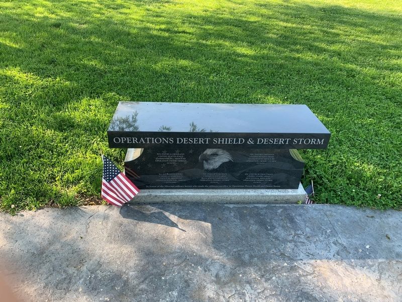
Operation Desert Shield & Desert Storm
In honor of the Missouri military heroes who made the ultimate sacrifice in Operation Desert Shield and Desert Storm.
CPL. Scott F Blanco, United States Marines, Troy, Missouri, Operation Desert Storm, 02/17/91 •
PFC Gerard A Cohen, United States, Army, St. Louis Missouri, 02/28/91 •
Lt. Patrick K Connor, United States Navy, Columbia, Missouri, Operation Desert Storm, 02/02/91 •
Lt. William Costen, United States navy, St. Louis Missouri, Operation Desert Storm, 01/18/91 •
SPC Steven P. Farnen, United States Army, Operation desert Storm, 02/25/1991 •
David A. Gilliland, United States Navy, Warrensburg, Missouri, Operation Desert Shield 10/30/90 •
SPC. David L Heyman, United States Army, Hazelwood, Missouri, Operation Desert Storm, 02/28/91 •
SA. Alexander Jones, United States Navy, St. Louis, Missouri,12/22/1990 •
SPC Phillip D Mobley, United States Army, Blue Spring, Missouri, Operation Desert Storm. 02/28/91 •
SPC. Steven R Tautman, United States Army, Houstonia, Missouri, Operation Desert Storm 02/26/91
Topics. This memorial is listed in this topic list: War, 1st Iraq & Desert Storm.
Location. 38° 31.161′ N, 90° 16.492′ W. Marker is in Lemay, Missouri, in St. Louis County. Memorial can be reached from North Road
Other nearby markers. At least 8 other markers are within walking distance of this marker. Missouri Military Memorial (within shouting distance of this marker); Jefferson Barracks Historic Site - Visitors Center, Laborer House and Stable (within shouting distance of this marker); A Longstanding, Strategically Central Military Post (about 500 feet away, measured in a direct line); Jefferson Barracks Historic Site - Tent City (about 500 feet away); Jefferson Barracks Historic Site North Gate (about 600 feet away); a different marker also named Jefferson Barracks Historic Site North Gate (about 700 feet away); Jefferson Barracks Historic Site - Old Ordnance Room (about 700 feet away); Jefferson Barracks Historic Site - World War II Reception Center #1772 (approx. 0.2 miles away). Touch for a list and map of all markers in Lemay.
Credits. This page was last revised on May 18, 2021. It was originally submitted on May 14, 2021, by Thomas Smith of Waterloo, Ill. This page has been viewed 195 times since then and 12 times this year. Photos: 1, 2. submitted on May 14, 2021, by Thomas Smith of Waterloo, Ill. • Devry Becker Jones was the editor who published this page.

