Born of Opportunity
The Story of our History
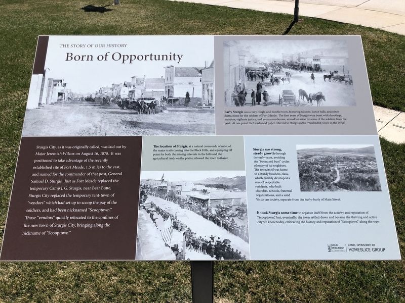
The location of Sturgis, at a natural crossroads of most of the major trails coming into the Black Hills, and a jumping off point for both the mining interests in the hills and the agricultural lands on the plains, allowed the town to thrive.
Early Sturgis was a very rough-and-tumble town, featuring saloons, dance halls, and other distractions for the soldiers of Fort Meade. The first years of Sturgis were beset with shootings, murders, vigilante justice, and even a murderous, armed invasion by some
this page online
Sturgis saw strong, stead growth through the early years, avoiding the "boom and bust" cycles of many of its neighbors. The town itself was home to a sturdy business-class, which quickly developed a core of respectable residents, who built churches, schools, fraternal organizations, and a solid Victorian society, separate from the hurly-burly of Main Street.
It took Sturgis some time to separate itself from the activity and reputation of "Scooptown", but, eventually, the town settled down and became the thriving and active city we know today, embracing the history and reputation of "Scooptown" along the way.
Erected by Nolin Monument Committee and Homeslice Group.
Topics. This historical marker is listed in these topic lists: Industry & Commerce • Settlements & Settlers. A significant historical date for this entry is August 16, 1878.
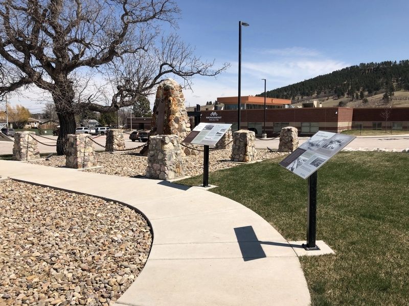
Location. 44° 24.122′ N, 103° 30.541′ W. Marker is in Sturgis, South Dakota, in Meade County. It is at the intersection of Junction Avenue and Harmon Street on Junction Avenue. Located

Regionally, this marker is in West River and in Greater Rapid City. It is also in the American Lewis & Clark Corridor, on the prairies, and on the Northern Plains. Globally, it is in North America, the Western Hemisphere, the Western World, and the Anglosphere. Historically, it finds itself in what was once Rupert’s Land and also the Louisiana Purchase.
Other nearby markers. At least 8 other markers are within 2 miles of this marker, measured as the crow flies: The Peace Keeping Post (here, next to this marker); The Fate of the Mail Carrier (a few steps from this marker); Broken Promises (a few steps from this marker); Charles Nolin (a few steps from this marker); Treaties are formed (a few steps from this marker); Charles Nolin, Pony Mail Carrier (a few steps from this marker); a different marker also named Charles Nolin (approx. 0.9 miles away); Civilian Conservation Corps Camps (approx. 1½ miles away). Touch for a list and map of all markers in Sturgis.
Credits. This page was last revised on May 30, 2021. It was originally submitted on May 28, 2021, by Ruth VanSteenwyk of Aberdeen, South Dakota. This page has been viewed 254 times since then and 9 times this year. Photos: 1, 2. submitted on May 28, 2021, by Ruth VanSteenwyk of Aberdeen, South Dakota. • Mark Hilton was the editor who published this page.
