Oliver Iron and Steel
Three Rivers Heritage Trail
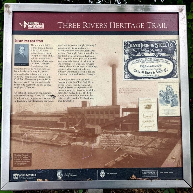
An optimistic pioneer in the business of steel manufacturing, Henry W. Oliver, founder of the company, was instrumental in developing the Mesabi iron ore mines near Lake Superior to supply Pittsburgh's factories with higher quality ores. To transport iron from the Great Lakes region to Pittsburgh, Oliver invested in the new Pittsburgh and Western Railroad. The company's use of giant steam shovels to scoop up the iron ore in Minnesota, and to transport it efficiently by Great Lakes ore boats and railways to Pittsburgh, resulted in lower prices for the steel industry. Oliver finally sold his iron ore business to his friend Andrew Carnegie.
In 1915 the
this page online
(captions)
Henry W. Oliver
Red and yellow brick floors from the factory's machine shop remain along the trail.
The base of this giant smokestack from the factory's power house can be found along the trail.
This stone pier once supported a wooden covered bridge that crossed the river here. The pier later supported a crane used by Oliver to hoist coal from barges.
The Oliver Iron and Steel factory used the river to receive and ship goods and supplies. Archives of Industrial Society, University of Pittsburgh
Erected by Friends of the Riverfront, DCNR, Steel Industry Heritage Corporation, City of Pittsburgh, SecondSole.
Topics. This historical marker is listed in this topic list: Industry & Commerce.
Location. 40° 25.919′ N, 79° 59.115′ W. Marker is in Pittsburgh, Pennsylvania,

Regionally, this marker is in the American Northeast, in the Mid-Atlantic, in the Ohio River Valley, in Appalachia, and specifically in Northern Appalachia. Globally, it is in North America, the Western Hemisphere, the Western World, and the Anglosphere. Historically, it finds itself in what was once the Viceroyalty of New France, the Haudenosaunee (Iroquois) Confederacy, and one of the original Thirteen Colonies.
Other nearby markers. At least 8 other markers are within walking distance of this marker: Immigrant Steel Workers (about 800 feet away, measured in a direct line); Pennsylvania Canal in Pittsburgh (approx. 0.2 miles away); Pittsburgh Glass (approx. 0.2 miles away); Panhandle Railroad (approx. 0.2 miles away); Ormsby River Farms (approx. 0.2 miles away); Black Diamonds (approx. 0.2 miles away); Coal Transportation (approx. 0.2 miles away); First Associated Reformed Church of Birmingham (approx. 0.2 miles away). Touch for a list and map of all markers in Pittsburgh.
Also see . . . Friends of the Riverfront. (Submitted on June 2, 2021.)
Credits. This page was last revised on February 2, 2023. It was originally submitted on June 2, 2021, by Bernard Fisher of Richmond, Virginia. This page has been viewed 663 times since then and 45 times this year. Photos: 1, 2. submitted on June 2, 2021, by Bernard Fisher of Richmond, Virginia.
