Near Hydro in Caddo County, Oklahoma — The American South (West South Central)
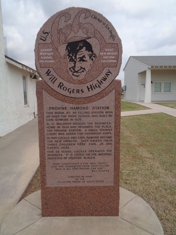
Provine/Hamons' Station
U.S. 66 - Will Rogers Highway
— Chicago to Los Angeles —
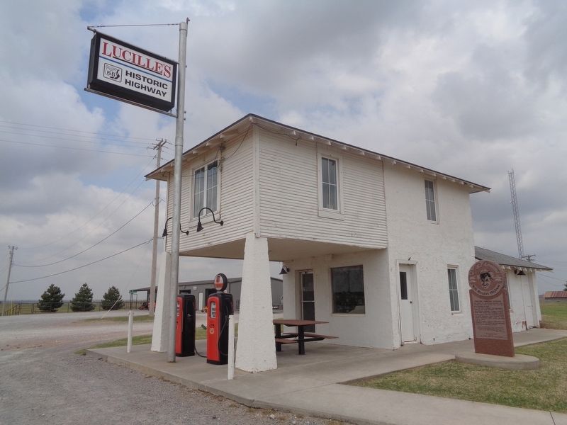
This rural Rt. 66 filling station with an over the drive design was built by Carl Ditmore in 1929.
W.O. Waldrop bought the business/home in 1934 and renamed the place, the Provine Station. A small tourist court was added for overnight stays.
In 1941 Lucille and Carl Hamons became the new owners. They raised their three children Dene, Carl, Jr. and Cheryl here.
For 59 years, Lucille operated the business. It is listed on the National Register of Historic Places.
"What constitutes a life well spent? Love and admiration from your fellow men is all that anyone can ask." - Will Rogers
Erected 2006 by Oklahoma Route 66 Association.
Topics and series. This historical marker is listed in these topic lists: Architecture • Industry & Commerce. In addition, it is included in the U.S. Route 66 series list. A significant historical year for this entry is 1929.
Location. 35° 32.221′ N, 98° 35.301′ W. Marker is near Hydro, Oklahoma, in Caddo County. Marker is on Old U.S. 66 east of South Coleman Avenue, on the right when traveling east. Touch for map. Marker is at or near this postal address: S Coleman Ave, Hydro OK 73048, United States of America. Touch for directions.
Other nearby markers. At least 8 other markers are within 5 miles of this marker, measured as the crow flies. The Baldwin Bridge (approx. 0.6 miles away); Hydro Veterans Memorial (approx. 3 miles away); McDonnell-Douglas F-4C Phantom II (approx. 4.6 miles away); Lt. Gen. Thomas P. Stafford (approx. 4.6 miles away); Lockheed F-104C "Starfighter" (approx. 4.6 miles away); Fairchild-Republic A-10 "Thunderbolt II" (approx. 4.6 miles away); Apollo Command Module (approx. 4.6 miles away); Lockheed T-33 "Shooting Star" (approx. 4.7 miles away). Touch for a list and map of all markers in Hydro.
Regarding Provine/Hamons' Station. U.S. Route 66 was well-known as the Main Street of America, or the Mother Road, but not Will Rogers Highway. A congressional resolution to name Route 66 in honor of Will Rogers was considered in 1935 but was not finalized. In 1952, a number of bronze markers were placed to promote the Warner Brothers film "The Will Rogers Story". The U.S. 66 Highway Associaton, Ford Motor Company, and Warner Brothers took part in the promotion. A caravan drove along Route 66 from St. Louis to Santa Monica placing markers at each state line declaring the name Will Rogers Highway. It was only a movie promotion, not an actual re-naming of the highway.
Also see . . .
Provine Service Station on Wikipedia. Lucille Hamons operated the station after her husband Carl's death in 1971. She stopped selling gas there in 1986 and continued to run it as a souvenir shop until her death in 2000. The original Hamons Court sign was donated by the family to the Smithsonian Museum of American History. Placed on the National Register of Historic Places (#97000803) in 1997. (Submitted on June 2, 2021, by Jason Voigt of Glen Carbon, Illinois.)

Photographed By Jason Voigt, April 9, 2021
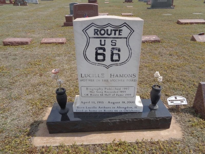
3. Lucille Hamons' grave
Hamons is buried next to her husband and her son, Carl Jr. She was known as the "Mother of the Mother Road" because of her generosity in helping out travelers. Buried at Hydro Masonic Cemetery, which is nearly two miles north of town off Highway 58.
Credits. This page was last revised on August 11, 2023. It was originally submitted on June 2, 2021, by Jason Voigt of Glen Carbon, Illinois. This page has been viewed 201 times since then and 22 times this year. Photos: 1, 2, 3. submitted on June 2, 2021, by Jason Voigt of Glen Carbon, Illinois.

