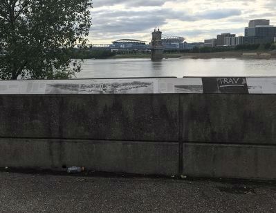
Newport in Campbell County, Kentucky — The American South (East South Central)
A New Perspective: 1865-1900
Inscription.
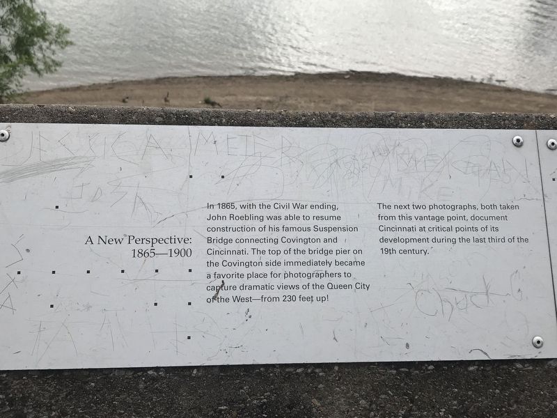
In 1865, with the Civil War ending, John Roebling was able to resume construction of his famous Suspension Bridge connecting Covington and Cincinnati. The top of the bridge pier on the Covington side immediately became a favorite place for photographers to capture dramatic views of the Queen City of the West from 230 feet up!
The next two photographs, both taken from this vantage point, document Cincinnati at critical points of its development during the last third of the 19th century.
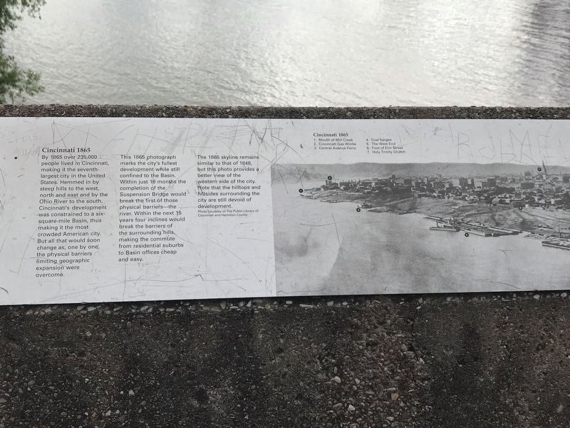
Cincinnati 1865
By 1865 over 235,000 people lived in Cincinnati, making it the seventh largest city in the United States. Hemmed in by steep hills to the west, north and east and by the Ohio River to the south, Cincinnati's development was constrained to a six-square-mile basin, thus making it the most crowded American city. But all that would soon change as, one by one, the physical barriers limiting geographic expansion were overcome.
This 1865 photograph marks the city's fullest development while still confined to the Basin. Within just 18 months the completion of the Suspension Bridge would break the first of those physical barriers the river. Within the next 15 years four inclines would break the barriers of the surrounding hills, making the commute from residential suburbs to Basin offices cheap and easy.
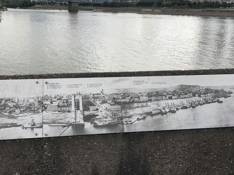
The 1865 skyline remains similar to that of 1848, but this photo provides a better view of the western side of the city. Note that the hilltops and hillsides surrounding the city are still devoid of development. Photo courtesy of The Public Library of Cincinnati and Hamilton County
[Photograph]
Cincinnati 1865 1. Mouth of Mill Creek 2. Cincinnati Gas Works 3.Central Avenue Ferry 4. Coal barges 5. The West End 6. Foot of Elm Street 7. Holy Trinity Church 8. Queen City Ferry No.2 9. Foot of Vine Street 10. Burnet House (hotel) 11. Foot of Walnut Street 12. Masonic Temple 13. St. Xavier Church 14. Sherman House (hotel) 15. Spencer House (hotel) 16. Public Landing 17. Christ Episcopal Church 18. Mt. Adams 19. St Philomena Church 20. Cincinnati Water Works
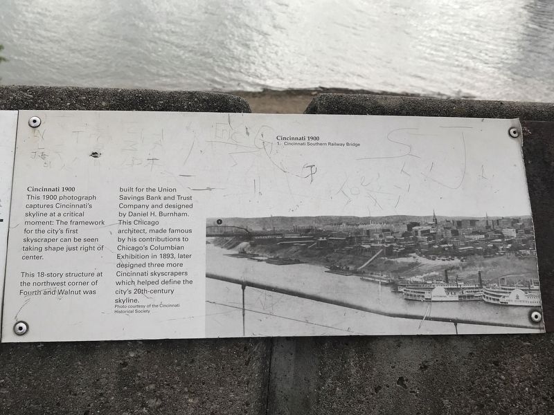
Cincinnati 1900
This 1900 photographs captures Cincinnati's skyline at a critical moment: The framework for the city's first skyscraper can be seen taking shape just right of center.
This 18-story structure at the northwest corner of Fourth and Walnut was built for the Union Savings Bank and Trust Company and designed by Daniel H. Burnham. This Chicago architect, made famous by his contributions to Chicago's Columbian Exhibition in 1893, later designed three more Cincinnati skyscrapers which helped
define the city's 20-th century skyline. Photo courtesy of the Cincinnati Historical Society
[Photograph]
Cincinnati 1900 1. Cincinnati Southern Railway Bridge (remainder is missing)
Topics. This historical marker is listed in these topic lists: Architecture • Bridges & Viaducts • Settlements & Settlers.
Location. 39° 5.545′ N, 84° 30.15′ W. Marker is in Newport, Kentucky, in Campbell County. Marker can be reached from Riverboat Row, on the right when traveling south. Marker is on the retaining wall surrounding the Taylor Park overlook. Touch for map. Marker is at or near this postal address: 100 Riverboat Row, Newport KY 41071, United States of America. Touch for directions.
Other nearby markers. At least 8 other markers are within walking distance of this marker. Skyscrapers and a Stadium: 1900-1972 (here, next to this marker); Cincinnati Skyline Pre-1865 (here, next to this marker); The Civil War in Northern Kentucky (here, next to this marker); Flood Walls (here, next to this marker); Defending the Valley (here, next to this marker); Fort Thomas (here, next to this marker); Floods and Flood Walls (a few steps from this marker); Newport Barracks (within shouting distance of this marker). Touch for a list and map of all markers in Newport.
More about this marker. Marker is a series of five
stamped metal panels and part of a sixth. The fifth panel is missing.
Credits. This page was last revised on July 15, 2021. It was originally submitted on June 7, 2021, by Duane and Tracy Marsteller of Murfreesboro, Tennessee. This page has been viewed 149 times since then and 18 times this year. Photos: 1, 2, 3, 4, 5. submitted on June 7, 2021, by Duane and Tracy Marsteller of Murfreesboro, Tennessee.
