Near Roll in Yuma County, Arizona — The American Mountains (Southwest)
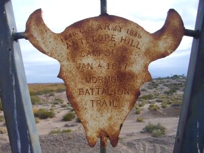
Antelope Hill Campsite
Antelope Hill
Campsite
Jan. 4 1847
Mormon
Battalion
Trail
Topics and series. This historical marker is listed in these topic lists: Churches & Religion • War, Mexican-American. In addition, it is included in the Mormon Battalion series list. A significant historical date for this entry is January 4, 1847.
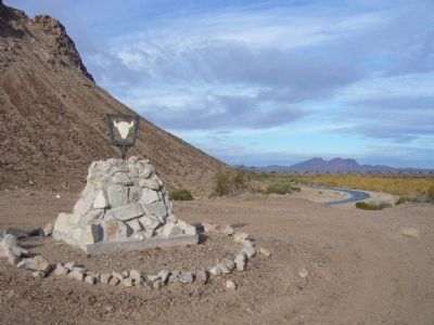
Location. 32° 42.61′ N, 114° 0.592′ W. Marker is near Roll, Arizona, in Yuma County. Marker can be reached from County 8th Street, 0.3 miles east of Mohawk Valley Road. Marker is on top of a small hill on the east side of the road. Touch for map. Marker is in this post office area: Roll AZ 85347, United States of America. Touch for directions.
Other nearby markers. At least 2 other markers are within 4 miles of this marker, measured as the crow flies. A different marker also named Antelope Hill Campsite (here, next to this marker); In Memory of Harold and Ethelind Woodhouse (approx. 3.6 miles away).
Related marker. Click here for another marker that is related to this marker.
Credits. This page was last revised on June 11, 2021. It was originally submitted on December 20, 2012, by Bill Kirchner of Tucson, Arizona. This page has been viewed 707 times since then and 28 times this year. Last updated on June 11, 2021, by Bud Henson of Midland, Michigan. Photos: 1, 2, 3. submitted on December 20, 2012, by Bill Kirchner of Tucson, Arizona. • J. Makali Bruton was the editor who published this page.


