Pineland in Sabine County, Texas — The American South (West South Central)
Pineland
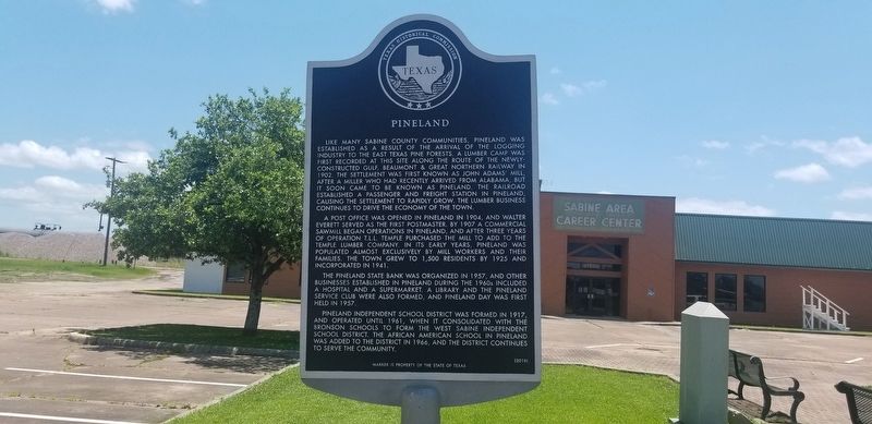
Like many Sabine County communities, Pineland was established as a result of the arrival of the logging industry to the east Texas pine forests. A lumber camp was first recorded at this site along the route of the newly-constructed Gulf, Beaumont & Great Northern Railway in 1902. The settlement was first known as John Adams’ Mill, after a miller who had recently arrived from Alabama, but it soon came to be known as Pineland. The railroad established a passenger and freight station in Pineland, causing the settlement to rapidly grow. The lumber business continues to drive the economy of the town.
A post office was opened in Pineland in 1904, and Walter Everett served as the first postmaster. By 1907 a commercial sawmill began operations in Pineland, and after three years of operation T.L.L. Temple purchased the mill to add to the Temple Lumber Company. In its early years, Pineland was populated almost exclusively by mill workers and their families. The town grew to 1,500 residents by 1925 and incorporated in 1941.
The Pineland State Bank was organized in 1957, and other businesses established in Pineland during the 1960s included a hospital and a supermarket. A library and the Pineland Service Club were also formed, and Pineland Day was first held in 1957.
Pineland Independent School District was formed in 1917, and operated
until 1961, when it consolidated with the Bronson Schools to form the West Sabine Independent School District. The African American school in Pineland was added to the district in 1966, and the district continues to serve the community.Erected 2010 by Texas Historical Commission. (Marker Number 16524.)
Topics. This historical marker is listed in this topic list: Settlements & Settlers. A significant historical year for this entry is 1902.
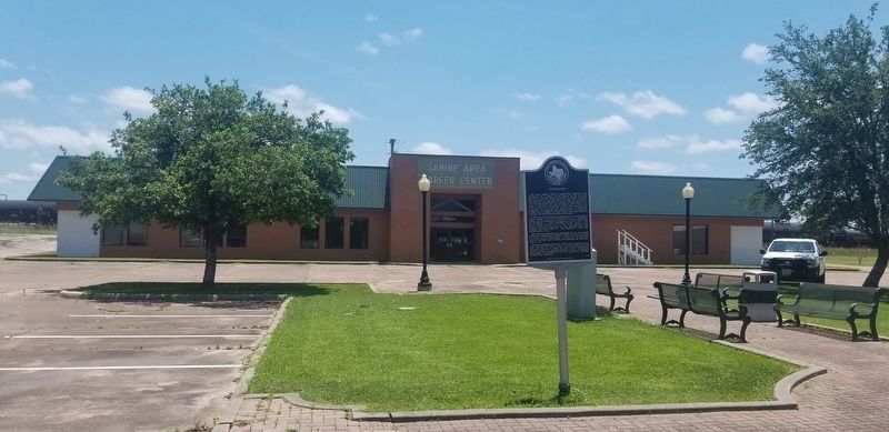
Location. 31° 15.041′ N, 93° 58.398′ W. Marker is in Pineland, Texas, in Sabine County. Marker is on South Temple Street (State Highway 1) near Sloan Street. Touch for map. Marker is at or near this postal address: 103 Sloan Street, Pineland TX 75968, United States of America. Touch for directions.
Other nearby markers. At least 8 other markers are within 10 miles of this marker, measured as the crow flies. Brookeland United Methodist Church (approx. 6.8 miles away); Site of East Mayfield (approx. 9 miles away); Hemphill Cemetery (approx. 9˝ miles away); Sabine County Jail (approx. 9.6 miles away); Sabine County (approx. 9.7 miles away); Hemphill (approx. 9.7 miles away); Sabine County Courthouse (approx. 9.7 miles away); a different marker also named Sabine County (approx. 9.7 miles away).
Credits. This page was last revised on June 13, 2021. It was originally submitted on June 13, 2021, by Cajun Scrambler of Assumption, Louisiana. This page has been viewed 217 times since then and 47 times this year. Photos: 1, 2. submitted on June 13, 2021, by Cajun Scrambler of Assumption, Louisiana.

