Blacksburg in York County, South Carolina — The American South (South Atlantic)
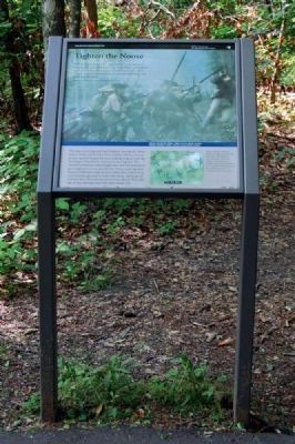
Tighten the Noose
Fire as quick as you can, and stand your ground as long as you can. When you can do no better, get behind trees, or retreat; but I beg you not to run quite off. It we are repulsed, let us make a point of returning, and renewing the fight....
Benjamin Cleveland, North Carolina patriot leader
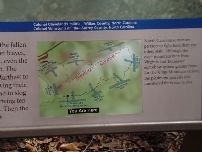
Colonel Cleveland's militia - Wilkes County, North Carolina
Colonel Winston's militia - Surrey County, North Carolina
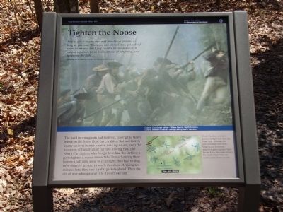
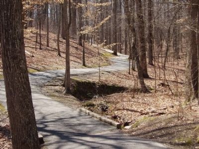
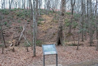
The hard morning rain had stopped, leaving the fallen leaves on the forest floor here sodden. But wet leaves, as any squirrel hunter knows, soak up sound, even the footsteps of hundreds of patriots moving fast. The North Carolinians who fought here had the farthest to go to tighten a noose around the Tories. Leaving their horses a half mile away to your right, they had to slog over swampy ground to reach this slope. Arriving ten minutes late, they saw loyalist pickets ahead. Then the din of war-whoops and rifle shots broke out.
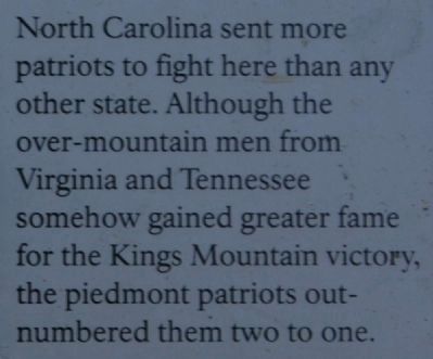
North Carolina sent more patriots to fight here than any other state. Although the over-mountain men from Virginia and Tennessee somehow gained greater fame for the Kings Mountain victory, the piedmont patriots out-numbered them two to one.
Erected by National Park Service.
Topics. This historical marker is listed in these topic lists: Patriots & Patriotism • War, US Revolutionary.
Location. 35° 8.622′ N, 81° 22.857′ W. Marker is in Blacksburg, South Carolina, in York County. Marker can be reached from Park Road, on the right when traveling east. Located along a 1.5 mile walking trail around the Kings Mountain Battlefield. Touch for map. Marker is at or near this postal address: 2625 Park Road, Blacksburg SC 29702, United States of America. Touch for directions.
Other nearby markers. At least 10 other markers are within walking distance of this marker. Shoot Tree to Tree (about 400 feet away, measured in a direct line); Lieutenant Colonel James Hawthorn (about 400 feet away); King's Mountain (about 400 feet away); Major Ferguson Falls (about 500 feet away); Col. Ferguson Fell (about 500 feet away); Col. Frederick Hambright (about 600 feet away); Colonel Patrick Ferguson Memorial (about 700 feet away); Major William Chronicle (about 700 feet away); Local Boys & Spies (about 700 feet away); Sacred to the Memory Monument (about 700 feet away). Touch for a list and map of all markers in Blacksburg.
More about this marker. A background photograph shows reenactors portraying the North Carolina militia. On the lower center is a map of the battle.
Also see . . .
1. Kings Mountain National Military Park (U.S. National Park Service). Thomas Jefferson called it "The turn of the tide of success." (Submitted on April 2, 2009, by Craig Swain of Leesburg, Virginia.)
2. Overmountain Men. The Overmountain Men were American frontiersmen from west of the Appalachian Mountains who took part in the American Revolutionary War. (Submitted on September 11, 2010, by Brian Scott of Anderson, South Carolina.)
3. Benjamin Cleveland. Benjamin Cleveland (1738–1806) was an American pioneer and soldier in North Carolina. (Submitted on September 11, 2010, by Brian Scott of Anderson, South Carolina.)
4. Kings Mountain National Military Park, Historic Resource Study, National Park Service. (Submitted on September 10, 2019.)
Credits. This page was last revised on September 11, 2019. It was originally submitted on April 1, 2009, by Stanley and Terrie Howard of Greer, South Carolina. This page has been viewed 1,023 times since then and 15 times this year. Photos: 1. submitted on April 1, 2009, by Stanley and Terrie Howard of Greer, South Carolina. 2, 3. submitted on September 11, 2010, by Brian Scott of Anderson, South Carolina. 4. submitted on April 1, 2009, by Stanley and Terrie Howard of Greer, South Carolina. 5, 6. submitted on September 11, 2010, by Brian Scott of Anderson, South Carolina. 7. submitted on August 22, 2010, by Bill Coughlin of Woodland Park, New Jersey. 8. submitted on April 1, 2009, by Stanley and Terrie Howard of Greer, South Carolina. 9. submitted on September 13, 2015, by Brandon Fletcher of Chattanooga, Tennessee. • Craig Swain was the editor who published this page.
