Atglen in Lancaster County, Pennsylvania — The American Northeast (Mid-Atlantic)
Mercerís Mill Covered Bridge (1880)
East Octoraro #2
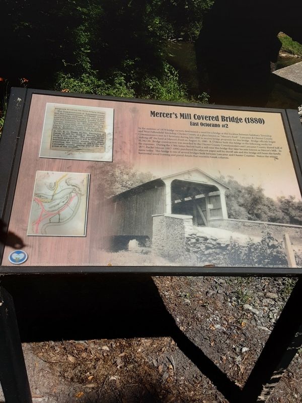
The Commissioners of Lancaster county met the Commissioners of Chester county at Christiana, on Tuesday, to receive proposals for the erection of a wooden bridge over the Octorara, between Lancaster and Chester counties, at Musser's Fording. The following bids were handed in: B. J. Carter, S1,562,50; Keogh & MoManns, $2,350; E. MoMellon, $2,097; John A. Welmor, $1,737; E. 0. Doets, $1,750; Darlington & Smith, $1,487.78; Ruth & Merritt, $2,030; Ruth & Co., $2,049. The contract has not yet been awarded, but it will be by the Commissioners of Chester county, they superintending the erection of the bridge and Lancaster county paying half of the expense of the erection.
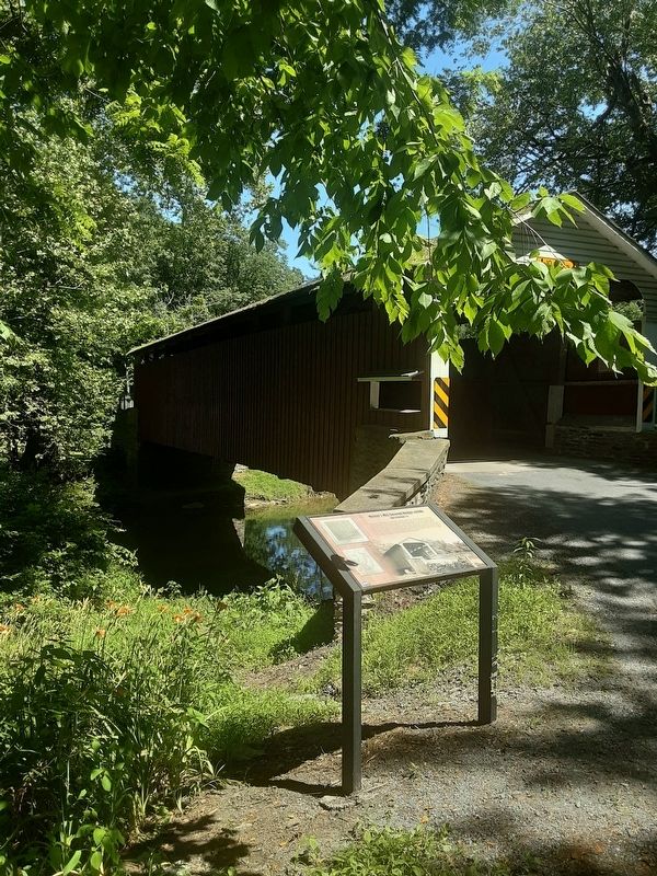
In the summer of 1878 bridge viewers determined a need for a bridge at this location between Sadsbury Township and West Fallowfield Township, Chester County at a place known as "Mercer's FordĒ. Lancaster & Chester County Commissioners met in Christiana during July 1880 to receive bridge proposals for this bridge. Bridge officials began staking off the land at Mercer's Ford on August 31, 1880. B. J. CŠrter built this bridge in the following weeks for $1,562.50. Bridge construction was awarded by the Chester County Commissioners and Lancaster County shared half of the expenses. During the 1780s James Sterritt built a mill near this bridge that later became known as Mercer's Mill. In 1877, Rachel Mercer (1817-1896) purchased the adjacent paper mill by sheriff sale and this bridge still bears the family name today. This bridge is one of several bridges built between Lancaster and Chester Counties. Notice the unique horizontal wood framing and portal details that resemble Greek columns.
Erected by Lancaster Bicycle Club.
Topics and series. This historical marker is listed in this topic list: Bridges & Viaducts. In addition, it is included in the Covered Bridges series list. A significant historical month for this entry is July 1880.
Location. 39° 55.888′ N, 75° 58.894′ W. Marker is in Atglen, Pennsylvania, in Lancaster County. Marker is on Bailey Crossroads Road, on the left when traveling east. Touch for map. Marker is at or near this postal address: 3771 Bailey Crossroads Road, Atglen PA 19310, United States of America. Touch for directions.
Other nearby markers. At least 8 other markers are within 4 miles of this marker, measured as the crow flies. East Octoraro #1 Bridge (1910-2020) (approx. 0.4 miles away); World War II (approx. 1.2 miles away); Atglen Borough Hall (approx. 1.3 miles away); Atglen (approx. 1.3 miles away); The Christiana Riot (approx. 1.7 miles away); Philadelphia & Columbia Railroad Bridge at Pine Creek, Circa 1830 (approx. 1.7 miles away); Christiana Riot Monument (approx. 1.8 miles away); 1917-1918 (approx. 3.9 miles away). Touch for a list and map of all markers in Atglen.
Regarding Mercerís Mill Covered Bridge (1880). Sorry, but when I looked up this bridge and zip code 19310 in web searches, I found a little of Atglen, PA 19310 in Lancaster County. Zip codes can cross county lines.
Credits. This page was last revised on June 21, 2021. It was originally submitted on June 17, 2021, by Carl Gordon Moore Jr. of North East, Maryland. This page has been viewed 226 times since then and 37 times this year. Photos: 1. submitted on June 17, 2021, by Carl Gordon Moore Jr. of North East, Maryland. 2, 3. submitted on June 18, 2021, by Carl Gordon Moore Jr. of North East, Maryland. • Bill Pfingsten was the editor who published this page.


