Nearby History
Explore Charlotte!
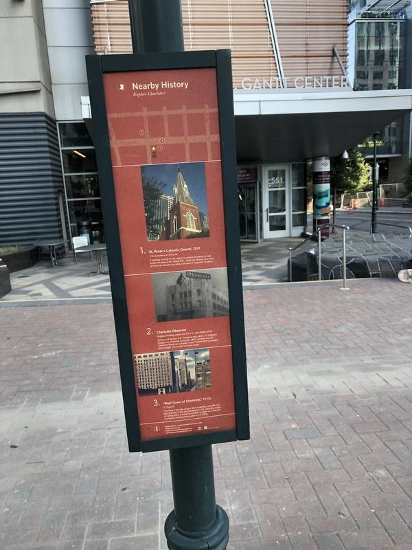
1. St. Peter's Catholic Church, 1893
1 block north on S. Tryon St.
Catholics arrived in this region in sizeable numbers to help build railroads in the 1850s-70s. Note the rectory next door, a Victorian townhouse with a whimsical "keyhole" window.
2. Charlotte Observer
Original building stood on S. Tryon St. near Stonewall St.
Cotton mill builder D.A. Tompkins and editor J.P. Caldwell bought the Charlotte Chronicle, 1882, remade it as the Charlotte Observer, a leader in the "Cotton Mill Campaign" that brought U.S. textile factories south.
3. "Wall Street of Charlotte," 1920s
S. Tryon St.
Charlotte's first skyscraper skyline sprang up as the city became the trading and banking hub for a bustling region of cotton mills, overtaking old New England as America's top textile manufacturing area in the 1920s.
Erected by City of Charlotte, North Carolina.
Topics. This historical marker is listed in these topic lists: Architecture • Industry & Commerce • Religion & Religious Structures. A significant historical year for this entry is 1893.
Location. 35° 13.41′ N, 80° 50.9′ W. Marker is in Charlotte, North
this page online

Regionally, this marker is in North Carolina’s Piedmont. It is also in the American South and specifically in the Upper South. Globally, it is in North America, the Western Hemisphere, the Western World, and the Anglosphere. Historically, it finds itself in what was once the territory of the Mississippian Culture, one of the original Thirteen Colonies, one of the Confederate States of America, and the Antebellum South.
Other nearby markers. At least 8 other markers are within walking distance of this marker: "More Hostile Than Any Other" (within shouting distance of this marker); African-American Contributions During the American Revolution (within shouting distance of this marker); J. P. Caldwell (within shouting distance of this marker); Ratcliffe's Flowers (about 400 feet away,
Credits. This page was last revised on February 3, 2023. It was originally submitted on June 20, 2021, by Devry Becker Jones of Washington, District of Columbia. This page has been viewed 277 times since then and 19 times this year. Photos: 1, 2. submitted on June 20, 2021, by Devry Becker Jones of Washington, District of Columbia.
