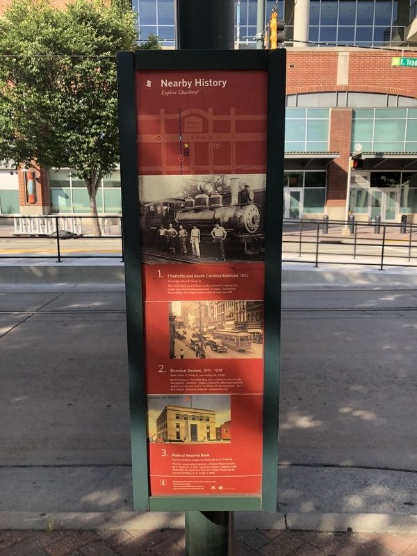
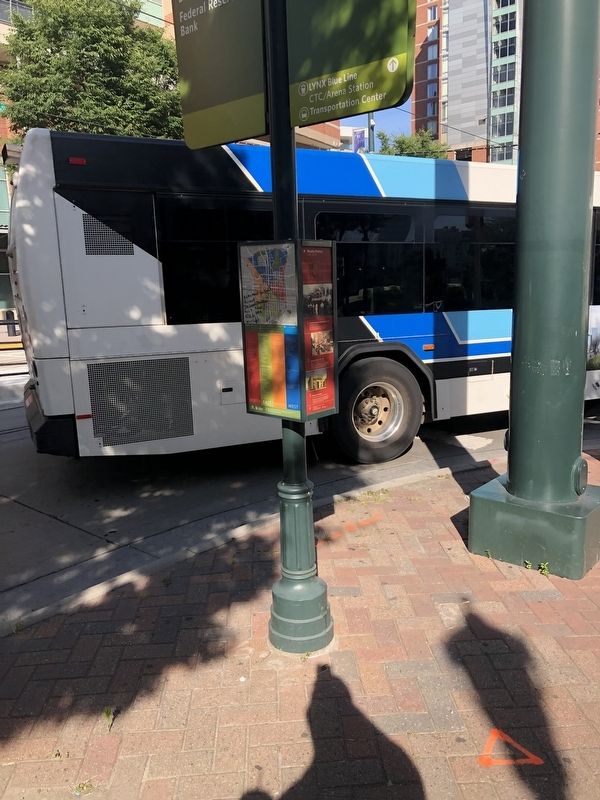
Nearby History
Explore Charlotte!
1. Charlotte and South Carolina Railroad, 1852
On bridge above E. Trade St.
The LYNX Blue Line follows route of the first railroad to reach into the Carolina piedmont. It made Charlotte a key trading city, triggering decades of rapid growth.
2. Streetcar System, 1891-1938
Photo shows E. Trade St. near College St., 1920s
Before buses or the LYNX Blue Line, streetcars fran on rails throughout Charlotte. Edward Dilworth Latta launched the system to help sell land in his Dilworth development - first of a ring of "streetcar suburbs" around the city.
3. Federal Reserve Bank
Current building stands two blocks east on E. Trade St.
The U.S. government opened a Federal Reserve bank on S. Tryon St. in 1927 (postcard above), helping make Charlotte an important financial center. Replaced by current building on E. Trade in 1989.
Erected by City of Charlotte, North Carolina.
Topics. This historical marker is listed in these topic lists: Industry & Commerce • Railroads & Streetcars. A significant historical year for this entry is 1852.
Location. 35° 13.487′ N, 80° 50.429′ W. Marker is in Charlotte, North
Other nearby markers. At least 8 other markers are within walking distance of this marker. Confederate Navy Yard (about 300 feet away, measured in a direct line); In Memory of George Davis, Attorney General of the Confederate States of America (about 500 feet away); Jefferson Davis (about 600 feet away); Dr. Ephraim Brevard Lived Near Here In 1775 (about 700 feet away); Queen Charlotte Walks In Her Garden (approx. 0.2 miles away); Charlotte's First Belk Store (approx. 0.2 miles away); Independence Square (approx. 0.2 miles away); Mecklenburg Declaration of Independence (approx. 0.2 miles away). Touch for a list and map of all markers in Charlotte.
Credits. This page was last revised on February 3, 2023. It was originally submitted on June 21, 2021, by Devry Becker Jones of Washington, District of Columbia. This page has been viewed 95 times since then and 8 times this year. Photos: 1, 2. submitted on June 21, 2021, by Devry Becker Jones of Washington, District of Columbia.

